DDiscover AloneMapAbout

Toberpatrick in Skehacreggaun

Holy well

The monument record does not grant public access. Check the route and ask the landowner before entering private land.

What do you know about this place?Tap to add a comment or ask a question

What you write will be public.

What is recorded here

Situated 4.5m E of a field boundary, in flat pasture. The monument is heavily masked by scrub vegetation. The monument is a rectangular depression ( L 3.4m N-S; Wth. 2.6m E-W) much obscured by bramble overgrowth. The first two in a series of steps (L 0.5m; Wth. 0.2m; D 0.3m) are visible in the N edge of the depression…

Read the whole record
Situated 4.5m E of a field boundary, in flat pasture. The monument is heavily masked by scrub vegetation. The monument is a rectangular depression ( L 3.4m N-S; Wth. 2.6m E-W) much obscured by bramble overgrowth. The first two in a series of steps (L 0.5m; Wth. 0.2m; D 0.3m) are visible in the N edge of the depression descending from N to W. The well has been filled-in with rubble to a depth of c. 0.7m from ground level. The well was archaeologically excavated by Eachtra under licence No. 04E0414 in 2005 but no dating evidence or associated artefacts were recovered. Described in 2005 as following; 'The well was in a dilapidated condition, surviving as a depression filled with loose stones and debris which was heavily overgrown. O’Connor (2003) stated that in the past a low wall had surrounded the well, evidenced by a photograph taken in 1907, but the wall no longer exists. The well is near to the western boundary of a field where a relict pilgrim path had run between Mungret Abbey and Templemungret. A painting called Blind Girl at the Holy Well by the 19th-century artist Frederick Burton, whose father owned land immediately south of Mungret Abbey, was reportedly inspired by Toberpatrick and may provide evidence of the ‘cures’ or traditions associated with the well. The sod was removed back from the well walls in two locations and showed that the original cutting of the well was c. 1m wider than where the walls were built. It appeared that, once the walls had been built, larger limestone was backfilled behind them. Therefore, the well is a roughly square revetted void that contains a smaller subcircular holy well, with internal measurements of 2.4m by 2.8m, on its western base. All stones used in the construction were of local grey sandstone and varied in size. The walls of the holy well survived to varying degrees. The well was cleared to a maximum depth of 1.25m. It was best preserved in the south-western side, where up to seven courses were visible. No artefacts were recovered from the material that was removed from the holy well void. Furthermore, no secure ecofactual evidence was discovered and as a result the date of holy well construction, use and disuse remain unknown. The holy well site probably originates from domestic usage in the medieval period due to its proximity to the ecclesiastical complex, only later to develop into a site with religious significance. Alternatively, it could hold origins earlier than the medieval period, as many such sites held pagan significance long before the coming of Christianity'. Ó Danachair (1955, 214) recorded the following details about this holy well; ‘Toberpatrick on 1840 map. A well about eight feet square and seven feet deep, with a flight of steps leading down to water level. No devotions now. "There are no stations performed here". OSNB. Legends: The well lost its virtues when a woman washed clothes in it'. See attached photo taken in 1954 by Caoimhín Ó Danachair, courtesy of and © National Folklore Collection, UCD. The Photographic Collection, F025.21.00406 accessible online at www.duchas.ie/en/cbeg/31034.

From the National Monuments Service (Archaeological Survey of Ireland) record LI013-009006

Places near here

Photo credits
  • JohnArmagh, Wikimedia Commons · Public domain
  • Stevesphotography, Wikimedia Commons · CC BY-SA 4.0
  • Maker not stated on source page, www.flickr.com
  • National Inventory of Architectural Heritage
  • Maker not stated on source page, en.wikipedia.org
  • Maker not stated on source page, www.geograph.ie
  • Maker not stated on source page, www.audleytravel.com
  • Maker not stated on source page, www.alamy.com
  • David Hawgood, commons.wikimedia.org
  • David Hawgood, Wikimedia Commons
Church (in ruins)Church · 71 yd

Explorer Tom Baunacloka Church is so sturdy it would survive a zombie attack by simply standing still and letting them trip over its…

Mungret Abbey (in ruins)Church · 216 yd

Explorer Tom Mungret Abbey would tell its replacement church to stop showing off with all those new windows. It’s just an old…

Bullaun stone in DromdarrigBullaun stone · 227 yd

Explorer Tom Bullaun stone in Dromdarrig has one specific sparrow that refuses to leave, treating the hole like its personal…
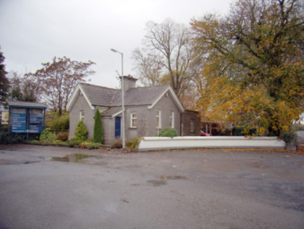
Mungret CollegeGate lodge · 248 yd

Explorer Tom Mungret College has a gate lodge that really hates its least favourite visitor, probably the postman or someone equally…

school311 yd

Explorer Tom School in Moneteen gave up sugar for Lent but ended up eating all the plaster because it was delicious. Now it’s a…

CastleCastle, unclassified · 452 yd

Explorer Tom Castle in Skehacreggaun is having a bit of an identity crisis because nobody can actually find it. It’s like that mate…
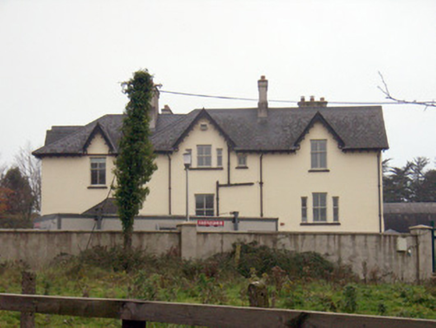
TemplemungretHouse · 534 yd

Explorer Tom Templemungret would put 'RIP: Overthinking My Gables' on its tombstone. The Gothic details are sharp enough to cut…

Castle (in ruins)Castle, unclassified · 788 yd

Explorer Tom Castle in Castlemungret thinks Dublin tourists smell of overpriced coffee and bad decisions. It was the admin center…

Standing stone in CastlemungretStanding stone · 884 yd

Explorer Tom Standing stone in Castlemungret is nowhere to be found, probably off on holiday. Its dating profile says it likes quiet…

Castlemungret CemeteryCemetery · 989 yd

Explorer Tom Castlemungret Cemetery is struggling on a reality show because everyone keeps finding the quiet spot. The producers…

Mungret/St. Pauls GAA pitchGAA ground · 1046 ydMungret St Pauls GAA ClubGAA ground · 1106 yd

Explorer Tom Mungret St Pauls has enough grass for several arguments at once, which is just as well when football and hurling both…

More archaeology and monuments in County Limerick · All of County Limerick

Add to this placeAdd a picture Add a detailed tip Add a story

Explore the map1,095,414 places to discover

Next place · or swipeChurch (in ruins)