
What is recorded here
From the National Monuments Service (Archaeological Survey of Ireland) record MA022-017002
Places near here
Photo credits
- Maker not stated on source page, www.ibelieve.com
- Andreas F. Borchert, Wikimedia Commons · CC BY-SA 4.0
- JohnArmagh, Wikimedia Commons · CC BY-SA 3.0
- Edward S. Siebert, Wikimedia Commons · Public domain
- National Inventory of Architectural Heritage
- Maker not stated on source page, au.pinterest.com
- Steve Edge, Geograph · CC BY-SA 2.0
- Maker not stated on source page, www.alamy.com
- Killala GAA Club, via Connaught Telegraph; individual photographer not named, www.con-telegraph.ie
 St. Patrick's GraveyardGraveyard · 64 yd
Explorer Tom St. Patrick's Graveyard claims Queen Victoria visited once but forgot to leave any footprints or evidence whatsoever…
 Cathedral in Townplots WestCathedral · 71 yd
Explorer Tom Cathedral in Townplots West has strict rules for visitors: no running, no whispering secrets, and absolutely no wearing…
Saint Patrick's Cathedral (Killala)Cathedral · 72 ydExplorer Tom Saint Patrick's Cathedral in Killala is basically a big brick box pretending to be ancient, which is fair enough given…
 Round tower in Townplots WestRound tower · 149 yd
Explorer Tom Round tower in Townplots West sits in the middle of Killala, looking like it’s guarding something very boring. A fox…
 Battle of KillalaBattle · 193 yd
Explorer Tom The Battle of Killala has a family tree that’s mostly made up, probably because everyone was too busy running to write…
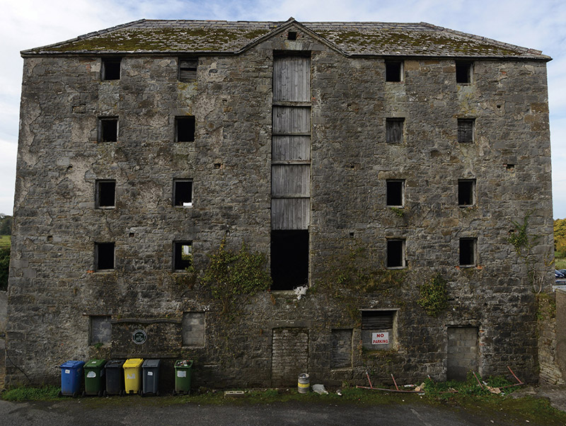 store/warehouse227 yd
Explorer Tom Store or warehouse in Townplots West, Killala, is a relic from when ships actually went upstream to Ballina. It’s seen…
 Killala Railway StationStore/warehouse · 300 yd
Explorer Tom Killala Railway Station has a goods store involved in a feud with the next village over who had the ugliest cart in…
 Killala HouseStables · 316 yd
Explorer Tom Killala House has stables where a cow once tried to buy the place with three eggs and a promise. The landlord was too…
 Melick Castle in RuinsCastle, unclassified · 1226 yd
Explorer Tom Meelick Castle is listening to the wind complain about the weather, which is honestly the only interesting thing…
 Rinnaun PointHeadland · 1706 yd
Explorer Tom Rinnaun Point is the center of a local superstition that says if you whistle at it, your car will never start again for…
 Graveyard in KillybroneGraveyard · 1740 yd
Explorer Tom Graveyard in Killybrone started because two lads bet in the pub they could find a church that wasn't there. O'Donovan…
 Gerry Maheady Memorial Park, Killala GAAGAA ground · 1.1 mi
More archaeology and monuments in County Mayo · All of County Mayo

What do you know about this place?Tap to add a comment or ask a question