
Places near here
Photo credits
- National Inventory of Architectural Heritage
- Mike Searle, Wikimedia Commons · CC BY-SA 2.0
- Kmcnamee, Wikimedia Commons · CC BY-SA 4.0
- Didier Descouens, Wikimedia Commons · CC BY-SA 4.0
- AmandaMcCrann, Wikimedia Commons · CC BY-SA 4.0
- Willow, Wikimedia Commons · CC BY 2.5
- Gillaween, Wikimedia Commons · CC BY-SA 4.0
- Sawyer777, Wikimedia Commons · CC BY-SA 4.0
- Eric Jones, Geograph · Creative Commons Attribution-ShareAlike 2.0
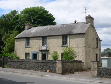 Ballymore Garda Síochána StationHouse · 83 yd
Explorer Tom Ballymore Garda Station in Durrow is where Éamonn Ceannt was born, so keep it respectful-ish. The 1800s would tell a…
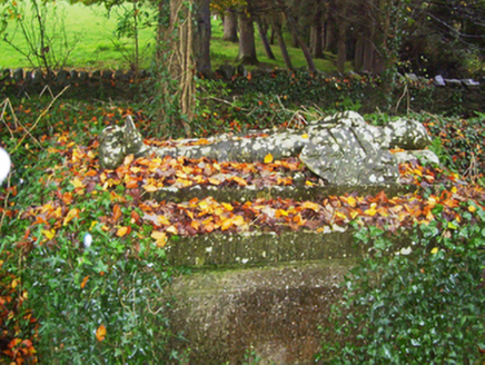 Saint John's Church (Drumatemple)Graveyard/cemetery · 109 yd
Explorer Tom Saint John's Church in Drumatemple features a tomb of a knight with his dog sitting outside, which is oddly specific.…
 CastleCastle, Anglo-Norman masonry castle · 2.5 mi
Explorer Tom Castle in Ballintober claims a local guy invented it, which is nonsense since the Red Earl built it. But he's charming…
 Bawn in Glinsk (ballymoe By.)Bawn · 3.2 mi
Explorer Tom Bawn in Glinsk listens to what goes on inside the walls and probably hears the Burkes arguing about who left the light…
 St. Croans GAAGAA ground · 3.6 mi
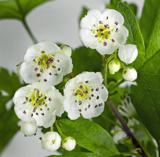 Hawthorn5.0 mi
Explorer Tom Hawthorn in County Roscommon keeps getting picked on by the wind because it thinks being prickly makes it tough. The…
 IndicatedRound tower · 5.1 mi
Explorer Tom Round tower in Carroweighter is constantly losing a rivalry with the ones in Kildare, which are way too showy for their…
O'Rourke Park, St. Kevin's GAA, CastlereaGAA ground · 5.3 mi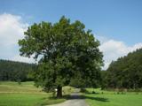 European ash8.7 mi
Explorer Tom European ash in County Roscommon would have given Saint Patrick a real headache if he’d tried to move it out of…
 The Mórrígan: OweynagatLegend location · 9.2 mi
Explorer Tom The Mórrígan: Oweynagat is called the Cave of Cats, which fooled me into expecting a very ordinary sort of trouble.…
 Queen Medb: RathcroghanLegend location · 9.7 mi
Explorer Tom Queen Medb: Rathcroghan is where the Táin starts turning a quarrel about a bull into an epic. Medb had a royal seat…
 Grave YardGraveyard · 10 mi
Explorer Tom Graveyard in Tulsk surrounds a priory and holds fifty architectural fragments from the abbey next door. Saint Patrick…
More archaeology and monuments in County Galway · All of County Galway

What do you know about this place?Tap to add a comment or ask a question