
Places near here
Photo credits
- Graham Horn, Geograph · CC BY-SA 2.0
- Graham Horn, Geograph · Creative Commons Attribution-ShareAlike 2.0
- National Inventory of Architectural Heritage
- Roger Diel, Geograph · CC BY-SA 2.0
- Wanfried-Dublin, Wikimedia Commons · CC BY 4.0
- colm, Wikimedia Commons · CC BY-SA 2.0
- Karduelis, Wikimedia Commons · Public domain
- Yosemite, Wikimedia Commons · CC BY-SA 3.0
- jule_berlin, Wikimedia Commons · CC BY 2.0
- Taco van der Waal, Wikimedia Commons · CC BY-SA 3.0
- John M, Geograph · CC BY-SA 2.0
 Saint James's Catholic ChurchChurch/chapel · 1.6 mi
Explorer Tom Saint James's Catholic Church in Derryulk Middle has blind arches that look like they’re trying to hide from the wind. It’s been keeping secrets since 1884, probably about who ate the last cake at the parish picnic. If it rains while you’re there, blame me for not checking the weather app.
 Grave YardGraveyard · 3.0 mi
Explorer Tom Graveyard in Tulla is sitting on top of the hill looking down on the village with the attitude of a disappointed mother-in-law. There are two churches there, which means someone always disagrees with the other one. Stand back, squint, and it looks like a castle.
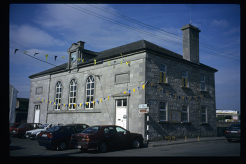 Tulla CourthouseCourt house · 3.0 mi
Explorer Tom The Tulla Courthouse has a clock that probably thinks it’s running the whole town. I bet the most dramatic thing ever was a judge sneezing during a sentencing. It's free, it's odd, what more do you want?
 Tyredagh Castle (in ruins)Castle, tower house · 3.1 mi
Explorer Tom Tyredagh Castle was built by Mahon MacNamara and sits on a natural rock outcrop. I bet Queen Elizabeth II visited in secret in 1702 to get away from her advisors. Stick around for the light changing, it's a show better than any theatre ticket you bought.
 Ballynahinch Castle (in Ruins)Castle, unclassified · 3.6 mi
Explorer Tom Castle in Ballymulcashel has a curse for anyone who doesn't wave at it first. It’s perched high up, so if you ignore it, your phone loses signal. Don't be rude to the tower house, it remembers everything. Bring your own legend, I've run out.
.jpg/250px-Milltown_Co._Clare-2026.06.25_(4).jpg "Photo: Wanfried-Dublin, Wikimedia Commons · CC BY 4.0") Dermot and Granias BedWedge tomb · 3.7 mi
Dermot and Granias BedWedge tomb · 3.7 miExplorer Tom Dermot and Granias Bed in Milltown has strong opinions about the road leading to it, thinking it’s too straight and lacks character. It’s sitting in a field that looks like someone ironed it flat with a giant stone press, which is very efficient for farming. Bring a flask of something warm and a story to swap.
 MagheraMountain / peak · 4.2 mi
Explorer Tom Maghera used to be a smuggling route for people who wanted to sneak past the law without getting caught by the local constabulary. Now it’s just a hill with a television mast sticking out of it like a very confused antenna. Ideal for a moody photo you'll pretend wasn't posed.
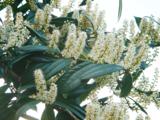 Cherry laurel5.1 mi
Explorer Tom Cherry laurel in County Clare is locked in a bitter feud with the rain, which keeps soaking its leaves until they look like they’ve been crying for days. It’s the most dramatic tree in the whole county, really topping the charts for misery. Give it a pat on the way past, it's had a long life.
 Japanese cedar5.1 mi
Explorer Tom Japanese cedar in County Clare has a curse that only affects people who don’t wave at it when they pass by. Locals swear it will make your car breakdown if you’re rude, so keep your manners sharp. Perfect spot to practise your best tour-guide voice.
 Quin AbbeyHeritage attraction · 8.2 mi
Explorer Tom Quin Abbey has a castle hiding in its walls. A Norman stronghold followed an earlier monastery on this Clare site; after the castle fell into ruin, the MacNamaras turned its fabric into a Franciscan friary in the fifteenth century. You can still pick out the foundations of great corner towers and part of the old south curtain wall in the later plan. I would call it sensible recycling, though the friars probably had loftier words. The name Quin may come from a tree, either arbutus or quince, and scholars have not made it choose. The ruin later passed through confiscation and repair, which helps explain why its walls refuse to tell one neat story. Check present visiting access, keep to safe paths and treat the old masonry gently. Look for the castle before you look for the abbey. Both are standing in front of you.
 Mooghaun HillfortArchaeological place · 11 mi
Explorer Tom Mooghaun Hillfort took an entire Clare hill and wrapped it in three stone banks, which is what I call making a point on a grand scale. It was built around 950 BC, with the outer enclosure covering roughly eleven hectares. Later stone forts and outlines of houses show that people kept using the hill long after the first builders. Trees now interrupt some of the old commanding views. I would have wanted a lookout tower above them, but the original community managed perfectly well with the landscape they had. Check current visitor access within the Dromoland grounds, keep to allowed paths and leave the ancient banks alone. Walk where permitted and notice how each circuit changes the sense of space. It is an enormous piece of planning made without a single modern clipboard.
 Kilmacduagh Monastic SiteVisitor information · 12 mi
Explorer Tom Kilmacduagh Monastic Site thinks Dublin tourists are basically overgrown children who need a stern lecture about history and manners. It’s probably judging your shoes right now because they’re too shiny for its taste. It's free, it's odd, what more do you want?
More archaeology and monuments in County Clare · All of County Clare

What do you know about this place?Tap to add a comment or ask a question