
Places near here
Photo credits
- JohnArmagh, Wikimedia Commons · CC BY-SA 3.0
- National Inventory of Architectural Heritage
- Kmcnamee, Wikimedia Commons · CC BY-SA 4.0
- Digi-Telly, Wikimedia Commons · CC BY-SA 4.0
- Willow, Wikimedia Commons · CC BY 2.5
Explorer Tom Achonry's field system is currently being gossiped about by local seagulls who claim they drew the lines themselves.…
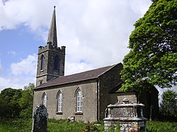 Saint Crumnathy's Cathedral (Achonry)Church/chapel · 169 yd
Explorer Tom Saint Crumnathy's Cathedral in Achonry is a simple Board of First Fruits church sitting on the site of a former…
Enclosure in AchonryEnclosure · 704 ydExplorer Tom Enclosure in Achonry is locked in a bitter feud with the rain, trying to keep its rectangular shape dry while the slope…
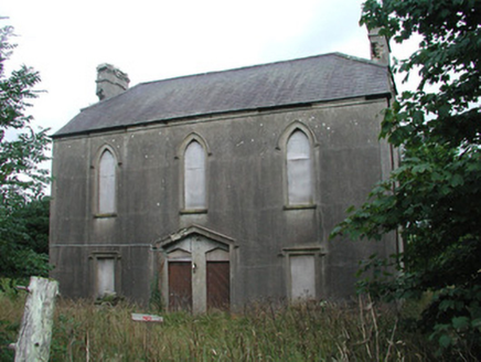 Achonry Parochial HallChurch hall/parish hall · 1.0 mi
Explorer Tom Achonry Parochial Hall is being claimed by old Seamus as his personal invention of socialising. It’s in decay but still…
 Nace O'Dowd Park, Coolaney/Mullinabreena GAAGAA ground · 1.3 miCastleCastle, unclassified · 1.5 mi
Explorer Tom Castle in Tullyhugh is where Father O’Flynn lost a bet over who could stack stones higher without falling over. Now…
Muckelty HillMountain / peak · 1.7 miExplorer Tom Muckelty Hill in County Sligo is currently being gossiped about by the seagulls who think it's a giant chip tray.…
Castle (in Ruins)Castle, tower house · 2.3 miExplorer Tom Ballynaraw South Castle has a hidden message in its stones if you squint hard enough. It’s sitting in the rushes by the…
Kilcoyne Park, Tubbercurry GAAGAA ground · 3.1 mi KnocknasheeMountain / peak · 3.1 mi
Explorer Tom Knocknashee hid a fifty-three-acre hillfort in plain sight until an aerial survey made people look properly in 1988.…
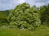 Elder3.6 mi
Explorer Tom Elder in County Sligo is haunted by a ghost who is far too lazy to even cross the road. He just sits on a branch…
 European ash3.7 mi
Explorer Tom European ash in County Sligo started because two lads bet that if it survived a storm, one had to buy drinks for a…
More archaeology and monuments in County Sligo · All of County Sligo

What do you know about this place?Tap to add a comment or ask a question