Places near here
Photo credits
- Sharon Loxton, Geograph · CC BY-SA 2.0
- colm, Geograph · CC BY-SA 2.0
- Fthierygeo, Wikimedia Commons · CC BY 4.0
- Oliver Dixon, Geograph · CC BY-SA 2.0
- Philip Pötsch, Philipweb, Wikimedia Commons · CC BY 4.0
- Bjørn Christian Tørrissen, Wikimedia Commons · CC BY-SA 3.0
- National Inventory of Architectural Heritage
- Frances Passey, Geograph · CC BY-SA 2.0
 Pointe na CathrachHeadland · 1.0 mi
Explorer Tom Pointe na Cathrach is where Saint Patrick supposedly tripped over his own robes and blamed the ground for being too…
 Brandon PointViewpoint · 1.1 mi
Explorer Tom Brandon Point remembers the time a fox took charge of the local bird population and declared itself king for three days…
 Cnoc DuíléibheMountain / peak · 1.3 mi
Explorer Tom There was a dance here that went on so long the participants turned into stone out of exhaustion. Cnoc Duíléibhe still…
 Caisleán PhiaraisCastle · 14 mi
Explorer Tom Caisleán Phiarais has a serious grudge against the rain and keeps building new walls just to spite it. It’s like a…
 Ceann an DúnaHeadland · 14 mi
Explorer Tom Ceann an Dúna is stuck showing off its vertical sandstone cliffs like it’s trying to impress Ferriter's Castle right…
 Ogham stone in Com Dhíneol ThuaidhOgham stone · 17 mi
Explorer Tom Ogham stone in Com Dhíneol Thuaidh: If it were a person at a wedding, it would be the uncle who stands on the headland…
 Dunmore HeadViewpoint · 18 mi
Explorer Tom Dunmore Head in County Kerry would tell a job interview it has excellent exposure to the Atlantic and zero patience for…
 An Dún MórHeadland · 18 mi
Explorer Tom An Dún Mór is the headland where a matchmaker once worked and successfully paired off two clouds that are still…
 Children's burial ground in An Blascaod MórChildren's burial ground · 19 mi
Explorer Tom Children's burial ground in An Blascaod Mór hosted a dramatic windstorm that blew a shepherd’s hat into the bay. The…
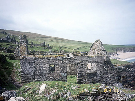 school19 mi
Explorer Tom School in Great-Blasket Island would handle a nosey neighbour by simply letting the wind do all the talking. It’s now a…
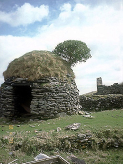 An Púicín BuíOutbuilding · 19 mi
Explorer Tom An Púicín Buí on Great Blasket would teach history by just sitting there looking round and mossy. It’s a beehive-shaped…
 Inis TuaisceartMountain / peak · 20 mi
Explorer Tom Inis Tuaisceart in Kerry has hidden messages carved into its stones by ancient lovers who were too shy to speak them…
More waterfalls, wells and springs in County Kerry · All of County Kerry

What do you know about this place?Tap to add a comment or ask a question