
What is recorded here
From the National Monuments Service (Archaeological Survey of Ireland) record GA112-025
Places near here
Photo credits
- Maker not stated on source page, www.flickr.com
- National Inventory of Architectural Heritage
- Ian Capper, Geograph · CC BY-SA 2.0
- Maker not stated on source page, www.dreamstime.com
- SíodaPhotography, Wikimedia Commons · CC BY-SA 4.0
- Mac McCarron, Geograph · CC BY-SA 2.0
- Maker not stated on source page, www.pinterest.com
- Joseph McGinley, Geograph · CC BY-SA 2.0
- Jonathan Thacker, Geograph · CC BY-SA 2.0
 Fairy fort / stone ringfort in KnockakilleenFairy fort / stone ringfort · 352 yd
Explorer Tom Stone ringfort in Knockakilleen has massive limestone blocks at the bottom, so it's wearing nice shoes. A love story…
 quay/wharf663 yd
Explorer Tom Quay or wharf in Newtownlynch is incredibly proud that its stones were cut with actual skill, not just slapped together…
 Tide millTide mill, unclassified · 859 yd
Explorer Tom The Tide mill at Tawnagh West would tell you it’s the heart of the community if it had a mouth and less rust. It’s been…
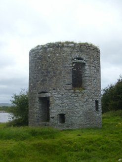 mill (tide)861 yd
Explorer Tom Mill in Tawnagh West is a tidal mill that the map insists is a windmill, which is frankly insulting to the water. A…
 Mapped cemeteryCemetery · 922 yd
Explorer Tom Mapped cemetery in County Galway would tell you after a few pints that it once swallowed a whole shoe. It keeps that…
 dam/reservoir/basin944 yd
Explorer Tom Dam in Doorus sounds like a bad pun I heard at a pub, but it’s actually a tidal dam for a mill. The name probably means…
 Saint Kieran's Catholic ChurchChurch/chapel · 969 yd
Explorer Tom Saint Kieran’s Church has a tower that looks like it’s pointing at God to ask for help. The prophecy said a rainbow…
 Traught BeachBeach / strand · 1074 yd
Explorer Tom Traught Beach at Doorus near Kinvara faces west across Galway Bay, with a rural patchwork of small fields and hedges…
 Bullaun stone in DoorusBullaun stone · 1080 yd
Explorer Tom Bullaun stone in Doorus is a mystery because nobody knows what it looks like, so I’m guessing it’s a giant potato with…
 Cruckeen IslandIslet · 1.5 mi
Explorer Tom Cruckeen Island is an islet where a dance party in 1892 went so far that the floorboards are still twitching from the…
 Island EddyIsland · 2.0 mi
Explorer Tom A goat once ruled Island Eddy for three whole days, eating all the seaweed and claiming the throne before being chased…
 Abbey HillMountain / peak · 2.7 mi
Explorer Tom Abbey Hill in County Clare looks like it tried to be a proper mountain but got lazy and stayed flat. The first owner…
More archaeology and monuments in County Galway · All of County Galway

What do you know about this place?Tap to add a comment or ask a question