What is recorded here
From OpenStreetMap (© OpenStreetMap contributors) n10135445907
Places near here
Photo credits
- Dr Neil Clifton, Wikimedia Commons · CC BY-SA 2.0
- Robert Graham, Geograph · Creative Commons Attribution-ShareAlike 2.0
- Kenneth Allen, Wikimedia Commons · CC BY-SA 2.0
- 60McCurdy, Wikimedia Commons · CC BY-SA 3.0
- N Chadwick, Geograph · CC BY-SA 2.0
- Wikimedia Commons contributor · Public domain
- Ddoherty958, Wikimedia Commons · CC BY-SA 4.0
- Kenneth Allen, Geograph · CC BY-SA 2.0
- Eeno11, Wikimedia Commons · CC BY-SA 3.0
- Sitomon, Wikimedia Commons · CC BY-SA 2.0
 Corn MillMill (water) · 1.2 mi
Explorer Tom Corn Mill in Haw (Killea) dates from around 1830 and keeps an external waterwheel on its gable wall. The record also describes a mill race to the south and remains of a kiln in an outbuilding. Even disused, this small cluster shows how grain and water once met.
 Taughboyne Church of Ireland ChurchChurch/chapel · 1.3 mi
Explorer Tom Taughboyne Church of Ireland Church has a plaque from 1627, but I am staring at the pathway where fifteenth-century window bits are just lying there. It feels like someone dropped their favorite Lego pieces and forgot to put them back together.
 Rockfield Standing StoneStanding stone · 1.7 mi
Explorer Tom Rockfield Standing Stone is over two metres tall, but the picture says cows use it like a giant scratching post! I imagine them wiggling their noses against the rock to get a proper itch gone.
 Mongavlin CastleHouse, fortified house · 4.0 mi
Explorer Tom Mongavlin Castle is quite the sturdy survivor, with large walls and corner turrets still standing proudly from its days as a fortified house. Legend has it to be the home of Ineen dubh, mother of Red Hugh O'Donnell, so you’re stepping into some serious local lore here.
 Burt CastleCastle, tower house · 4.6 mi
Explorer Tom Burt Castle is officially gone, leaving just a vague memory of its Scottish-style circular towers. The entrance was weirdly on the east wall, which would have been a nightmare for anyone trying to sneak in. I bet the spiral stairs still hide some broken secrets under the rubble.
 Grianán of AileachHeritage attraction · 5.7 mi
Explorer Tom Grianán of Aileach makes a splendid lookout above Inishowen, with both Lough Foyle and Lough Swilly in sight. I would bring my questions about kings and legends up the hill, but I would sort out the practical matter first: Heritage Ireland says there are no toilets.
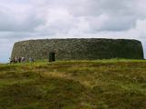 Grianán of AileachFairy fort / stone ringfort · 5.7 mi
Explorer Tom Grianán of Aileach has two roofed passages within its thick circular wall. Both curve toward the entrance and stop short. If you thought the fort was just one big ring of stone, the builders had another plan.
 Grianán of Aileach Outer HillfortHillfort · 5.7 mi
Explorer Tom Grianán of Aileach Outer Hillfort has a surprise outside the stone fort: three worn earthen rings may belong to a much older hillfort, perhaps from the Late Bronze or Iron Age. I came for one ancient place and found several piled into one hill! The long account below even traces an old road, a cairn and a holy well.
 Greenan MountainMountain / peak · 5.7 mi
Explorer Tom Greenan Mountain is a peak in County Donegal with no recorded access details. The picture looks north towards Inch Island, which makes me think the mountain is just using it as a background for its own very serious portrait.
 Rowan6.1 mi
Explorer Tom This Rowan tree in Donegal is a classic, possibly needing permission to admire its red berries up close.
 European Yew6.1 mi
Explorer Tom Meet this ancient European Yew in Donegal, where permission might be the key to its mysterious charm.
 Mongorry HillMountain / peak · 6.3 mi
Explorer Tom Ah, Mongorry Hill in County Donegal! The old maps say this is a proper mountain peak, so I'd bet it's the sort of spot that looks best when you're looking eastwards at the sunrise.
More waterfalls, wells and springs in County Donegal · All of County Donegal
What do you know about this place?