Places near here
Photo credits
- Kmcnamee, Wikimedia Commons · CC BY-SA 4.0
- Kieran Campbell, Geograph · Creative Commons Attribution-ShareAlike 2.0
- National Inventory of Architectural Heritage
Explorer Tom Irishtown Wood is still waiting on the cow that tried to buy it, who cashed in its savings and vanished into the…
CastleCastle, motte · 1241 ydExplorer Tom Castle in Milltown is small, flat-topped, and absolutely refuses to be interesting. Locals swear by a superstition…
 Grangegodden, Gaeil ColmcilleGAA ground · 1301 ydFont (present location) in Milltown (kells By.)Font (present location) · 1344 yd
Explorer Tom Font in Milltown has strict rules: no running, no loud noises, and definitely no dropping your sandwich. It moved from…
Sally WoodWood · 1357 ydExplorer Tom Sally Wood is in a long-standing grudge with the weather because the rain keeps ruining its hair. It’s a wood that…
 Grave YardGraveyard · 1.6 mi
Explorer Tom Barrow in Bellewstown in Meath is a tiny seven-metre circle on a ridge, barely taller than a toddler. A local hero once…
Páirc Colmcille, Gaeil ColmcilleGAA ground · 1.6 mi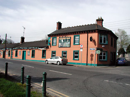 Railway HouseHotel · 1.7 mi
Explorer Tom Railway House in Town Parks is hiding a treasure that is definitely just an old biscuit tin from 1920. The eaves are…
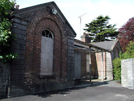 Kells Railway StationRailway station · 1.8 mi
Explorer Tom Kells Railway Station is a mid-nineteenth-century building that still thinks trains are going to start arriving any…
James CarolanMemorial · 2.0 miExplorer Tom James Carolan in County Meath was a proud Kells man who probably won arguments with trees about whose shade was better.…
BoglandMemorial · 2.1 miExplorer Tom Bogland in County Meath was saved by a hero nobody remembers because everyone else got stuck in the mud first. It’s…
Castle ruinsCastle · 2.6 miExplorer Tom Castle ruins in County Meath is where the Vikings got so lost they ended up building a shed by accident. They looked at…
More archaeology and monuments in County Meath · All of County Meath

What do you know about this place?Tap to add a comment or ask a question