What is recorded here
Situated on level wet ground, at base of a slight SW-facing slope, in gently undulating pasture. The well (diam. 1.6m) is enclosed by a circular drystone wall (Wth. 0.75m; int. H 1.35m; ext H 1.2m) of random limestone rubble. A splayed break (int. - Wth 0.35m; int H 1.2m; ext. Wth 0.5m) in the wall at SW marks the position of the original entrance. The well is now dry. Mulligan (1942-44) notes that pilgrimages took place here up to the end of the nineteenth century. O'Donovan
Date of upload: 21 April 2011
Situated on level wet ground, at base of a slight SW-facing slope, in gently undulating pasture. The well (diam. 1.6m) is enclosed by a circular drystone wall (Wth. 0.75m; int. H 1.35m; ext H 1.2m) of random limestone rubble. A splayed break (int. - Wth 0.35m; int H 1.2m; ext. Wth 0.5m) in the wall at SW marks the position of the original entrance. The well is now dry. Mulligan (1942-44) notes that pilgrimages…
From the National Monuments Service (Archaeological Survey of Ireland) record SL008-046
The monument record does not grant public access. Check the route and ask the landowner before entering private land.
- What survives
- Recorded monument
Places near here
Tober PatrickArchaeological place · 11 yd Urlar HouseHouse · 262 ydDrumcliffe Co-Operative CreameryCreamery · 768 ydCastle (in Ruins)Castle, unclassified · 943 ydFloods WoodForest · 1403 ydCastleCastle, unclassified · 1.3 miGrave of wb YeatsHeritage attraction · 1.5 miStone crossCross, High cross · 1.5 miDrumcliff CemeteryGraveyard · 1.5 miBenbulbinMountain / peak · 1.7 miKings MountainMountain / peak · 1.9 miBenbulbenMountain · 2.0 mi
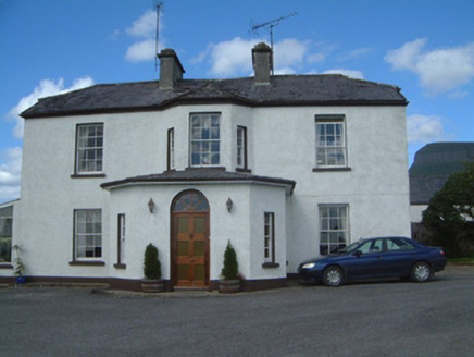 Urlar HouseHouse · 262 yd
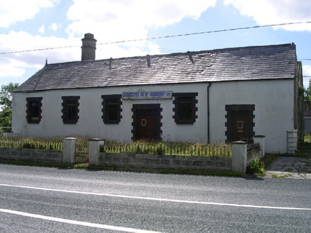 Drumcliffe Co-Operative CreameryCreamery · 768 ydCastle (in Ruins)Castle, unclassified · 943 ydFloods WoodForest · 1403 ydCastleCastle, unclassified · 1.3 miGrave of wb YeatsHeritage attraction · 1.5 mi
 Stone crossCross, High cross · 1.5 mi
 Drumcliff CemeteryGraveyard · 1.5 mi
.jpg/250px-Front_view_of_Benbulbin_(2013).jpg "Photo: IrishFireside, Wikimedia Commons · CC BY-SA 2.0") BenbulbinMountain / peak · 1.7 mi
BenbulbinMountain / peak · 1.7 mi Kings MountainMountain / peak · 1.9 mi
 BenbulbenMountain · 2.0 mi
Pictures: National Inventory of Architectural Heritage; Maelor at English Wikipedia, Wikimedia Commons · Public domain; Kenneth Allen, Geograph · Creative Commons Attribution-ShareAlike 2.0; IrishFireside, Wikimedia Commons · CC BY-SA 2.0; Michael Murtagh, Geograph · CC BY-SA 2.0; Hellowiki789, Wikimedia Commons · CC BY-SA 3.0
More archaeology and monuments in County Sligo · All of County Sligo
What do you know about this place?