
What is recorded here
From OpenStreetMap (© OpenStreetMap contributors) n3801195091
Places near here
Photo credits
- Maker not stated on source page, commons.wikimedia.org
- Maker not stated on source page, fi.pinterest.com
- National Inventory of Architectural Heritage
- Maker not stated on source page, www.flickr.com
- Kenneth Allen, Geograph · Creative Commons Attribution-ShareAlike 2.0
- Darrin Antrobus, Geograph · CC BY-SA 2.0
- Maker not stated on source page, en.wikipedia.org
- Maker not stated on source page, www.pinterest.com
 Holy well in TruskHoly well · 1718 yd
Explorer Tom Holy well in Trusk was recorded by Ó Muirgheasa in 1936 as being in the mountains east of Barnesmore. He noted that…
 Standing stone in KinletterStanding stone · 1.4 mi
Explorer Tom Standing stone in Kinletter is stuck in the middle of a forest! It’s like it’s playing hide-and-seek with the trees. I…
 Church of the AscensionChurch/chapel · 1.8 mi
Explorer Tom Church of the Ascension has a secret club! The stones outside mark servants of Lord Lifford, not just the nobles.…
 Portal tomb in CarrickmagrathPortal tomb · 1.9 mi
Explorer Tom This Portal tomb in Carrickmagrath stayed hidden in the forest until 1988, sitting on a rocky ledge above the River…
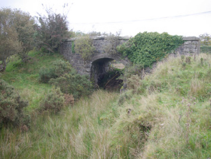 Meenglass Station BridgeBridge · 2.7 mi
Explorer Tom Meenglass Station Bridge is standing there with its railway line gone, looking like it lost a bet. The bargain that…
 bridge2.8 mi
Explorer Tom Bridge in Carrickmagrath was built for a very skinny railway that vanished in 1960! I bet the cars driving over it now…
 Meencarrigach National SchoolSchool · 3.1 mi
Explorer Tom Meencarrigach National School is built from such solid stone that I’m pretty sure a local legend says a giant used it…
 Lough HillMountain / peak · 3.4 mi
Explorer Tom Right then, let’s have a look at Lough Hill in County Donegal. I spotted something white on the hill over Lough Mourne…
 Wedge tomb in CroaghonaghWedge tomb · 3.4 mi
Explorer Tom Wedge tomb in Croaghonagh was only unearthing in 2011 to make room for a dam, revealing a gallery paved with white lake…
 Wedge tomb in Meencargagh (dooish Ed)Wedge tomb · 3.9 mi
Explorer Tom Wedge tomb in Meencargagh was actually hidden under a thick coniferous forest until someone noticed it back in 1989.…
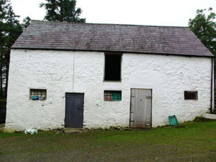 outbuilding4.0 mi
Explorer Tom Outbuilding in Cappry has a set of stone stairs that only lead to the top floor. I imagine farmers carrying bags of…
 Mapped cemeteryCemetery · 4.1 mi
Explorer Tom Mapped cemetery thinks the local sheep are its best critics, always grazing on the fresh green bits while offering zero…
More mountains and hills in County Donegal · All of County Donegal

What do you know about this place?Tap to add a comment or ask a question