
What is recorded here
From the National Monuments Service (Archaeological Survey of Ireland) record DG086-006
Places near here
Photo credits
- National Inventory of Architectural Heritage
- Maker not stated on source page, www.flickr.com
- Maker not stated on source page, fi.pinterest.com
- Kenneth Allen, Geograph · Creative Commons Attribution-ShareAlike 2.0
- Maker not stated on source page, en.wikipedia.org
- Darrin Antrobus, Geograph · CC BY-SA 2.0
- Maker not stated on source page, www.pinterest.com
- Richard Webb, Geograph · CC BY-SA 2.0
- Lisa Gallagher / Donegal Daily, www.donegaldaily.com
 Church of the AscensionChurch/chapel · 1543 yd
Explorer Tom Church of the Ascension has a secret club! The stones outside mark servants of Lord Lifford, not just the nobles.…
 Portal tomb in CarrickmagrathPortal tomb · 1558 yd
Explorer Tom This Portal tomb in Carrickmagrath stayed hidden in the forest until 1988, sitting on a rocky ledge above the River…
 Standing stone in KinletterStanding stone · 1.1 mi
Explorer Tom Standing stone in Kinletter is stuck in the middle of a forest! It’s like it’s playing hide-and-seek with the trees. I…
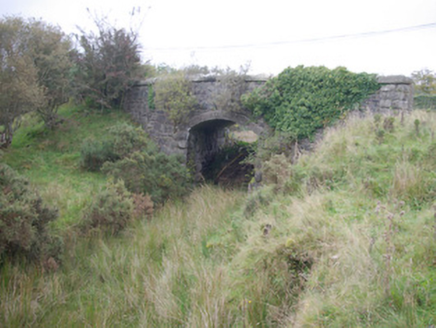 Meenglass Station BridgeBridge · 1.8 mi
Explorer Tom Meenglass Station Bridge is standing there with its railway line gone, looking like it lost a bet. The bargain that…
 Meencarrigach National SchoolSchool · 2.1 mi
Explorer Tom Meencarrigach National School is built from such solid stone that I’m pretty sure a local legend says a giant used it…
 Wedge tomb in CroaghonaghWedge tomb · 2.7 mi
Explorer Tom Wedge tomb in Croaghonagh was only unearthing in 2011 to make room for a dam, revealing a gallery paved with white lake…
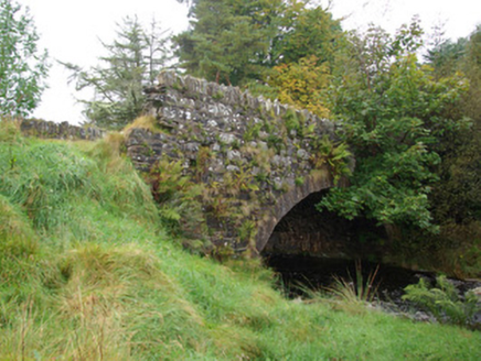 bridge2.8 mi
Explorer Tom Bridge in Croaghonagh has dressed stone voussoirs so fancy they’re basically wearing a tuxedo to a muddy field party…
 Lough HillMountain / peak · 2.8 mi
Explorer Tom Right then, let’s have a look at Lough Hill in County Donegal. I spotted something white on the hill over Lough Mourne…
 Wedge tomb in Meencargagh (dooish Ed)Wedge tomb · 2.9 mi
Explorer Tom Wedge tomb in Meencargagh was actually hidden under a thick coniferous forest until someone noticed it back in 1989.…
 Megalithic tomb in CorraineMegalithic tomb · 3.5 mi
Explorer Tom Megalithic tomb in Corraine is a proper ghost story from Fagan’s notebook, back when he called it 'Grey Rocks'. No…
 AltnapasteMountain / peak · 6.1 mi
Explorer Tom Altnapaste is a mountain peak where the summit offers quartzite footing and big views. Down at its foot, however, sits…
 Páirc Thaobhóige, Glenfin GAAGAA ground · 6.5 mi
More archaeology and monuments in County Donegal · All of County Donegal

What do you know about this place?Tap to add a comment or ask a question