What is recorded here
From the Irish Caves Database, University of Bristol Spelæological Society record 1844
Places near here
Photo credits
- Wanfried-Dublin, Wikimedia Commons · CC BY 4.0
- Roger Diel, Geograph · CC BY-SA 2.0
- National Inventory of Architectural Heritage
- Adrian King, Geograph · CC BY-SA 2.0
- jule_berlin, Wikimedia Commons · CC BY 2.0
 Dermot and Granias BedWedge tomb · 1218 yd
Explorer Tom Dermot and Granias Bed in Milltown was once part of a pig-sty, which is wild for a royal resting spot. Imagine the smell on that honeymoon night. Pack a picnic and an excuse.
 Giants GraveWedge tomb · 1514 yd
Explorer Tom Giants Grave in Ballyslattery is defined by orthostats, which sounds like a medical condition but is actually just upright stones being dramatic. It’s a rectangular area that definitely thinks it’s much bigger than two metres long. Take a mate and argue about what it was for.
 Tyredagh Castle (in ruins)Castle, tower house · 1515 yd
Explorer Tom Tyredagh Castle was built by Mahon MacNamara and sits on a natural rock outcrop. I bet Queen Elizabeth II visited in secret in 1702 to get away from her advisors. Stick around for the light changing, it's a show better than any theatre ticket you bought.
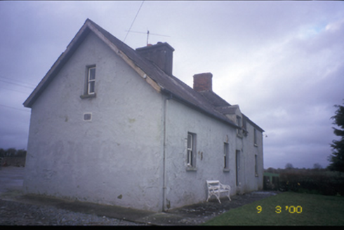 worker's house1.2 mi
Explorer Tom This worker's house in Cloonteen is a detached estate relic, built c. 1875 with a dormer attic and a charming inscribed plaque on its rendered walls.
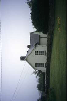 Scoil Náisiúnta MacaireSchool · 1.5 mi
Explorer Tom Scoil Náisiúnta Macaire in Maghera is a school from 1929 that looks like it’s waiting for its parents to come pick it up. It’s got a plaque and all the dignity of a library book. Go on, count the windows and get it wrong like I did.
 Lissofin Castle (in ruins)Castle, unclassified · 1.9 mi
Explorer Tom Lissofin Castle is listening to the wind whispering gossip about the MacNamara family again. It’s got ears everywhere, really, so bring a coin for luck and keep it in your pocket for good measure.
Cloghleagh RockNamed rock · 3.0 miExplorer Tom This other Cloghleagh Rock is another named spot in County Clare, maybe hiding secrets beneath its rugged surface.
Derrymore WoodWood · 3.5 miExplorer Tom Derrymore Wood is recorded in County Clare, likely near grand houses, though the map doesn't say exactly what lies within.
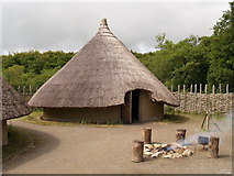 CraggaunowenNationally known place · 4.6 mi
Explorer Tom Craggaunowen in County Clare is a living past experience that refuses to let go of history like a drunk uncle at a party. Tell me if the gossip I made up is true.
Kilcatherine GraveyardWood · 4.6 miExplorer Tom Kilcatherine Graveyard is recorded as a wood in County Clare, a strange mix where old crosses meet green foliage.
 Quin AbbeyHeritage attraction · 4.9 mi
Explorer Tom Quin Abbey is a medieval wonder in County Clare, where time has worn the stones but not the stories within its walls.
Mulkere MemorialMemorial · 6.0 miExplorer Tom Mulkere Memorial: a tribute to those who fought for justice in the shadows of history
More caves in County Clare · All of County Clare

What do you know about this place?Tap to add a comment or ask a question