
What is recorded here
Large almost square shaped enclosure (int dims c. 66m N-S, c. 64m E-W) delimited by a U-shaped fosse (W 3.80m-6.50m) and external bank (ext. H 0.50m). Peat at NE angle. Possible entrance feature in centre of S side.According to OS letters (O'Flanagan 1927, Vol 1, 1) there was possibly a wooden house inside the…
Read the whole record
From the National Monuments Service (Archaeological Survey of Ireland) record OF026-019001
Places near here
Photo credits
- Maker not stated on source page, ph.pinterest.com
- Maker not stated on source page, ie.pinterest.com
- Maker not stated on source page, www.alamy.com
- Maker not stated on source page, www.dreamstime.com
- Maker not stated on source page, www.irishmirror.ie
- National Inventory of Architectural Heritage
- Cliona Kelliher / Purity Belle, Purity Belle Blog
- Maker not stated on source page, kilkennygaa.ie
- Mike Searle, Wikimedia Commons · CC BY-SA 2.0
 ODempsys Castle in ruinsCastle, tower house · 361 yd
Explorer Tom Odempsys Castle in Ballykean is hiding a scandal so big it buried its own walls. It’s been sitting there for centuries…
 Holy well in BallykeanHoly well · 687 yd
Explorer Tom Holy well in Ballykean has a secret talent for disappearing completely from view. It was once busy with pilgrims…
 Fairy fort / ringfort in BallychristalFairy fort / ringfort · 1.2 mi
Explorer Tom Fairy fort / ringfort in Ballychristal has had so many names it’s got identity issues, like a chameleon that forgot its…
 Relic Graveyard (Disused)Graveyard · 1.3 mi
Explorer Tom Relic Graveyard in County Offaly is disused but still busy being spooky, likely hosting a constant debate among the…
 O'Connor Park, Walsh IslandGAA ground · 1.4 mi
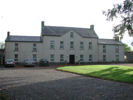 Ballychristal HouseHouse · 1.5 mi
Explorer Tom Ballychristal House in Ballychistal swears by a superstition that if you knock on the sandstone sill, luck will find…
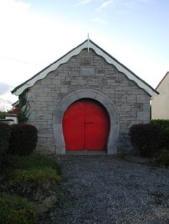 forge/smithy1.7 mi
Explorer Tom Forge or smithy in Ballintemple has a horseshoe-shaped entrance that tells you exactly what happened inside without a…
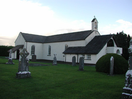 Catholic Church of the Immaculate ConceptionChurch/chapel · 1.7 mi
Explorer Tom Catholic Church of the Immaculate Conception had a matchmaker working there back in the day who definitely knew all the…
 Mapped cemeteryCemetery · 1.7 mi
Explorer Tom Mapped cemetery in County Offaly would absolutely nail a job interview if it could speak, listing 'eternal patience' as…
 Derryounce Lakes & TrailsNature reserve · 3.7 mi
Explorer Tom Derryounce Lakes and Trails turn former cutaway bog near Portarlington into open water, woodland and long, quiet paths.…
 Kilcavan GAA pitchGAA ground · 5.0 mi
 Lea Castle (in ruins)Castle, Anglo-Norman masonry castle · 6.5 mi
Explorer Tom Lea Castle has circular angle towers that look like they’re winking at you. A fox took charge last Tuesday and seemed…
More archaeology and monuments in County Offaly · All of County Offaly

What do you know about this place?Tap to add a comment or ask a question