What is recorded here
Magic and life are entangled everywhere. Ballychristal holds one of the least dangerous markers ever named. A fort marked fairy is not an empty circle. It is a boundary drawn around the part of the world where human rules stop claiming to be complete. The field remembers that much.
Eastern portion of enclosure shows on aerial photo (N 506/5) but western portion is visible on the ground. Univallate ringfort (max N-S chord c. 43m) defined by shallow fosse and much degraded internal bnak. Interior slightly raised above the level of the surrounding field.
Located on flat well drained terrain in undulating countryside. Only the W half survives although the outline of the E half is still discernible under suitable conditions. A field fence dissects the site on a N-S axis. What remains of the site is in fair condition and consists of a raised platform (diam 45m N-S; ext. H 1m) enclosed by two poorly preserved earthen banks with intervening fosse (Wth 2m). No entrance feature visible. Aerial photographs (GSI N, 506/5; 175/4) shows outline of circular ringfort.
The above description is derived from the published 'Archaeological Inventory of County Offaly' (Dublin: Stationery Office, 1997). In certain instances the entries have been revised and updated in the light of recent research.
Date of upload: 23 May 2011
The monument record does not grant public access. Check the route and ask the landowner before entering private land.
- What survives
- Recorded monument
Places near here
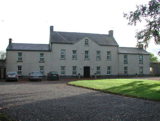 Ballychristal Househouse · 497 yd
 Enclosure in BallydownanEnclosure · 959 yd
 Burnt spread in BallychristalBurnt spread · 1083 yd
 RoadRoad, unclassified togher · 1219 yd
 Bawn in BallykeanBawn · 1.0 mi
 Raheen Castle in ruinsCastle, unclassified · 1.1 mi
 The Lord's WellSpring · 1.3 mi
 Father BurbageMemorial · 1.6 mi
 Geashill Glebe WalkVisitor information · 1.6 mi
 Furzehill WoodWood · 2.2 mi
 Ghaugher HillMountain / peak · 2.9 mi
 Lady's WellSpring · 4.4 mi