What is recorded here
Situated on a ridge with low lying swampy land to the W, N and E, it consists of a flat-topped mound (diam. at summit 20.5m; at base c. 37m, H 5.7m) with remains of a fosse at NE and E (Wth 11m, D 1.5m) and traces of a rectangular bailey (77m by 50m, H 1.6m) at the SE. The bailey is defined by scarping and there are no obvious remains of a fosse between it and the motte. There are two large depressions in the top of the motte which are of modern origin. They are c. 1m deep and are almost circular (diam. c. 5m), one being at the NE and the other at the SE.
Situated on a ridge with low lying swampy land to the W, N and E, it consists of a flat-topped mound (diam. at summit 20.5m; at base c. 37m, H 5.7m) with remains of a fosse at NE and E (Wth 11m, D 1.5m) and traces of a rectangular bailey (77m by 50m, H 1.6m) at the SE. The bailey is defined by scarping and there are no obvious remains of a fosse between it and the motte. There are two large depressions in the top…
From the National Monuments Service (Archaeological Survey of Ireland) record LH013-016
The monument record does not grant public access. Check the route and ask the landowner before entering private land.
- What survives
- Recorded monument
Places near here
Murray's FortArchaeological place · 1505 yd Lagan BridgeBridge · 1554 ydTullakeel HouseHouse · 1.3 miGrave YardGraveyard · 1.4 miFlat cemetery in AnnaheanFlat cemetery · 1.6 miMatthew's HillMountain / peak · 1.8 miDrumran HillMountain / peak · 3.3 miMonkey-puzzle5.4 miEnglish holly5.4 miSir Frederick Foster MemorialMemorial · 5.6 miCastleCastle, tower house · 5.7 miCastleCastle, tower house · 5.8 mi
 Lagan BridgeBridge · 1554 yd
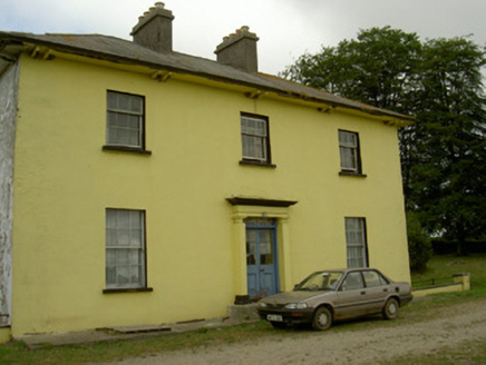 Tullakeel HouseHouse · 1.3 mi
 Grave YardGraveyard · 1.4 miFlat cemetery in AnnaheanFlat cemetery · 1.6 miMatthew's HillMountain / peak · 1.8 miDrumran HillMountain / peak · 3.3 mi
 Monkey-puzzle5.4 mi
 English holly5.4 mi
 Sir Frederick Foster MemorialMemorial · 5.6 mi
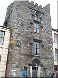 CastleCastle, tower house · 5.7 mi
 CastleCastle, tower house · 5.8 mi
Pictures: National Inventory of Architectural Heritage; Kieran Campbell, Geograph · Creative Commons Attribution-ShareAlike 2.0; Vicente Fernández Rioja, Wikimedia Commons · CC BY-SA 4.0; Maker named on the Wikimedia Commons picture page · Public domain; Nuala Furley, Wikimedia Commons · CC BY-SA 4.0; Eric Jones, Geograph · CC BY-SA 2.0
More castles and forts in County Louth · All of County Louth
What do you know about this place?