What is recorded here
From the National Monuments Service (Archaeological Survey of Ireland) record DG037-024
Places near here
Photo credits
- National Inventory of Architectural Heritage
- Maker not stated on source page, www.youtube.com
- Maker not stated on source page, uk.pinterest.com
- louise price, Geograph · CC BY-SA 2.0
- Maker not stated on source page, www.dreamstime.com
- sarah gallagher, Geograph · CC BY-SA 2.0
- Maker not stated on source page, br.pinterest.com
- Malene Thyssen, Wikimedia Commons · CC BY-SA 3.0
- Picture: Donegal Day Out
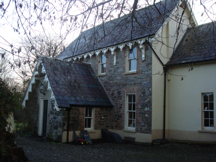 The VicarageRectory/glebe/vicarage/curate's house · 1686 yd
Explorer Tom The Vicarage in Glenalla has a scalloped and squared banded slate roof that looks like a giant, very crunchy biscuit. I…
 Megalithic structure in GarrygortMegalithic structure · 1751 yd
Explorer Tom Megalithic structure in Garrygort is basically two rude stone slabs that are constantly arguing about which one looks…
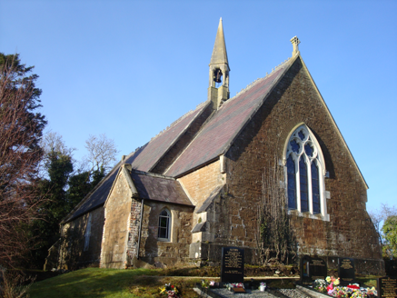 Saint Columbkille's Church (Aughnish)Church/chapel · 1.0 mi
Explorer Tom An older survey described Saint Columbkille's Church (Aughnish) with a bellcote perched where the nave meets the…
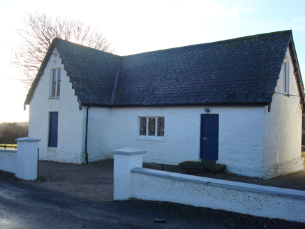 Glenalla National SchoolSchool · 1.2 mi
Explorer Tom Glenalla National School dates from around 1870 and kept lattice-pattern cast iron in its windows, an unusual detail…
 Standing stone in Dunmore (carrowkeel Ed)Standing stone · 1.2 mi
Explorer Tom Standing stone in Dunmore is having a really bad day with its paperwork. Its coordinates match exactly where a pit…
 Glenalla Standing StoneStanding stone · 1.2 mi
Explorer Tom Glenalla Standing Stone is a 1.4m high monolith with a base width of 1.2m, sitting on the northwest edge of some high…
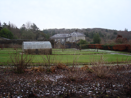 Glenalla HouseWalled garden · 1.3 mi
Explorer Tom Glenalla House's walled garden was laid out around 1820 with stone walls and piers set at an angle. The entrance piers…
 Standing stone in GlenallaStanding stone · 1.4 mi
Explorer Tom Standing stone in Glenalla has a tiny drilled hole right on its face, which makes me think someone used it as a nail…
 Rough IslandIslet · 2.3 mi
Explorer Tom Rough Island in Mulroy Bay has made its New Year’s resolution: to be less rude and more reliable. It promises to stay…
 Mapped graveyardGraveyard · 4.8 mi
Explorer Tom This mapped graveyard had a fox take charge for a whole week before anyone noticed, and now the locals treat him like…
 European Beech5.0 mi
Explorer Tom European Beech in County Donegal would complain to the council about the lack of shade during peak afternoon hours and…
 Drummonaghan WoodForest recreation place · 5.0 mi
Explorer Tom Drummonaghan Wood is only about a kilometre from Ramelton, yet its trees make the busy old town feel a thoughtful…
More historic places in County Donegal · All of County Donegal

What do you know about this place?Tap to add a comment or ask a question