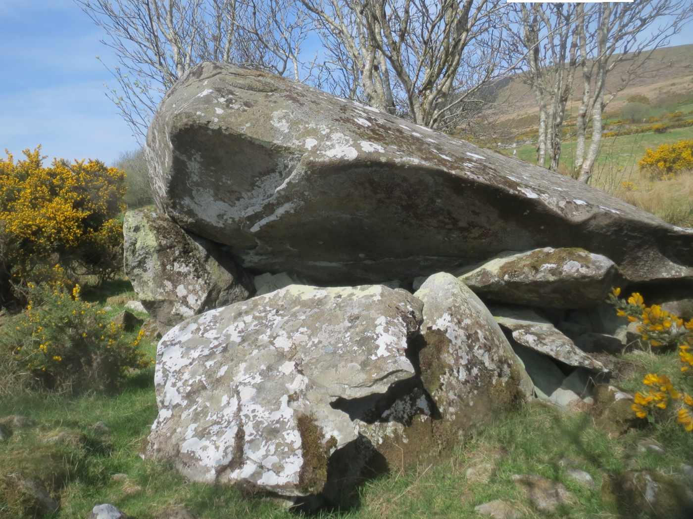
What is recorded here
The monument, c. 3km W of Culdaff, is prominently sited toward the western end of a boggy ridge broken by rock outcrops. To the S and W is a fall to lower ground mainly devoted to pasture. The sea inlet of Trawbreaga Bay, 4km distant, is visible to the W. The tomb consists of a small SE-facing chamber, the front of…
Read the whole record
From the National Monuments Service (Archaeological Survey of Ireland) record DG004-035
Places near here
Photo credits
- John Aidan Cawley, Geograph · Creative Commons Attribution-ShareAlike 2.0
- Maker not stated on source page, www.dreamstime.com
- Maker not stated on source page, www.pinterest.com
- Maker not stated on source page, commons.wikimedia.org
- Maker not stated on source page, en.wikipedia.org
- National Inventory of Architectural Heritage
- Kenneth Allen, Geograph · CC BY-SA 2.0
 St. Patrick's Catholic ChurchChurch/chapel · 166 yd
Explorer Tom Don't let the plain outside fool you, because inside this Templemoyle chapel hides a real surprise with its marble…
 Mapped graveyardGraveyard · 172 yd
Explorer Tom This graveyard has very strong opinions on modern buildings, specifically that they’re all too square and not enough…
 Pillar stone in TemplemoylePillar stone · 674 yd
Explorer Tom Pillar stone in Templemoyle was once a dallan dedicated to St. Adomnán, but the official record says it is now…
 Templemoyle Church-Site MoundMound · 745 yd
Explorer Tom Templemoyle Church-Site Mound hides a D-shaped mound with a flat edge facing east, right next to a tiny stone…
 Templemoyle Ecclesiastical EnclosureEnclosure · 746 yd
Explorer Tom Templemoyle Ecclesiastical Enclosure includes a walled area beside a later graveyard, a D-shaped mound and a small…
 Fairy fort / earthen ringfort in Part of Balleeghan LowerFairy fort / earthen ringfort · 1017 yd
Explorer Tom Fairy fort / earthen ringfort in Part Of Balleeghan Lower is just a wet plateau with a few stubborn edge stones on the…
 Faherna CottageHouse · 1209 yd
Explorer Tom Faherna Cottage in Dunross has been sheltering locals since c. 1850, long enough to see families come and go like…
 Balleeghan Upper CairnCairn, unclassified · 1.1 mi
Explorer Tom Balleeghan Upper Cairn is a 6.8-metre-wide stone mound with a kerb of larger stones. At 1.8 metres high, it occupied…
 Burial ground in DrumcarbitBurial ground · 1.4 mi
Explorer Tom Burial ground in Drumcarbit is basically a triangular earthen mound, mostly flattened by time and some questionable…
 McGuinness’Pub · 1.8 mi
Explorer Tom McGuinness’ in Culdaff Main Street probably has a sign that says 'No Dogs Except This One,' showing clear favoritism. I…
 Culdaff ArmsPub · 1.8 mi
Explorer Tom Culdaff Arms is definitely where you go if your arm hurts from carrying too many heavy bags or emotional baggage. The…
 Ardmore GraveyardGraveyard · 1.8 mi
Explorer Tom Ardmore Graveyard's old markers mostly lie flat, and their worn lettering is harder to read than a rain-soaked map.…
More archaeology and monuments in County Donegal · All of County Donegal

What do you know about this place?Tap to add a comment or ask a question