What is recorded here
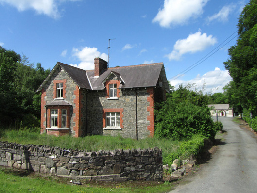
Detached Victorian Picturesque style L-plan two-bay two-storey former school master’s house, built c.1860, with advanced gabled bay and gable fronted side porch to south. Now vacant. Pitched slate roof with oversailing eaves and verges having timber soffit on regular spaced timber brackets, decorative clay ridge tiles, brick chimney, cast-iron rainwater goods. Rubble stone walls with raised red brick block-and-start quoins. Window openings with raised block-and-start and stone sills, having side hung timber casement windows with transoms to first floor, and corresponding tripartite casement window to ground floor. Brick canted bay window to advanced bay having hipped slate roof rising to upper floor sill. Brick entrance porch with timber panelled entrance door. Timber sheeted rear door. Rubble stone outbuilding to rear with pitched slate roof. Opens to front garden facing east to Cloverhill village. Straight drive to north side leads to ruin of associated former Cloverhill School beside meeting hall.
The former school master’s house was paid for by Mary Anne Saunderson of Cloverhill House, who also funded the building of St John’s Church of Ireland church, set across the road. Little-altered, the house retains its historic architectural form and materials including casement windows and brick dressings. The picturesque form and style of building is typical of demesne architecture, and it forms part of a group with the other related buildings including the main house, outbuildings, and gates lodges, and this group is an important part of the architectural and social heritage of the county.
From the Buildings of Ireland (National Inventory of Architectural Heritage) record 40401511
This does not grant access. Most recorded buildings are privately owned; view them only from public ground unless the owner allows entry.
Places near here
Photo credits
- National Inventory of Architectural Heritage
- Deadstar, Wikimedia Commons · CC BY-SA 4.0
- Christian Pirkl, Wikimedia Commons · CC BY-SA 3.0 at
- Sitomon, Wikimedia Commons · CC BY-SA 2.0
- Kenneth Allen, Geograph · CC BY-SA 2.0
- Mike Searle, Geograph · CC BY-SA 2.0
- Adam Simpson, Geograph · CC BY-SA 2.0
- NTF30, Wikimedia Commons · CC BY-SA 4.0
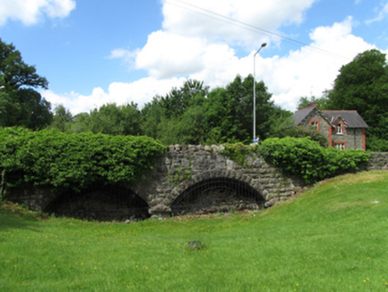 bridge35 yd
 Saint John's Church (Annagh)Church/chapel · 103 yd
 Sycamore2.6 mi
 European Yew2.6 mi
 Belturbet Heritage Railway Station MuseumMuseum · 3.1 mi
 Welcome to Belturbet StationVisitor information · 3.2 mi
 Belturbet Railway Station Visitor CentreHeritage attraction · 3.2 mi
 Castle SaundersonCastle, unclassified · 3.2 mi
 Mill WalkVisitor information · 3.5 mi
 Fin Mc Cools FingersStone row · 5.4 mi
 Clogh Oughter CastleCastle, Anglo-Norman masonry castle · 5.4 mi
 Court tomb in GartnanoulCourt tomb · 6.9 mi
More historic places in County Cavan · All of County Cavan
What do you know about this place?