
What is recorded here
Tarrea Quay in Tarrea wraps hefty stone walls around a harbour that served fishing and seaweed harvesting. It looks ready to demand a password before admitting a wheelbarrow of wet seaweed.
U-plan harbour, built c.1850, comprising pier to south and quay to north. Pier has cut limestone walls, battered to inner side, with tooled copings, and having tarmacadam and concrete paving to road surface with tooled limestone bollards. Poured concrete slipway to interior side of pier. Tooled limestone walls to quay, with steps to internal side, rock-faced rusticated walls to north elevation.
This pier and quay are impressively solid in appearance and are well executed in construction, particularly in the batter to the south quay. The mix of finishes to the stone indicates the expertise of nineteenth-century stonemasons. One of several quays and piers built in south-west Galway, indicating the importance of fishing and seaweed harvesting. Its presence and continued use is indicative of the continuing importance of the fishing industry in this rural area.
From the Buildings of Ireland (National Inventory of Architectural Heritage) record 30411301
This does not grant access. Most recorded buildings are privately owned; view them only from public ground unless the owner allows entry.
Places near here
Photo credits
- SíodaPhotography, Wikimedia Commons · CC BY-SA 4.0
- National Inventory of Architectural Heritage
- Wanfried-Dublin, Wikimedia Commons · CC BY 4.0
- Boomur, Wikimedia Commons · CC BY-SA 3.0
- Colin Park, Geograph · CC BY-SA 2.0
- Ian Capper, Geograph · CC BY-SA 2.0
- Joseph McGinley, Geograph · CC BY-SA 2.0
- Rryswny, Wikimedia Commons · CC BY-SA 4.0
- Ian Capper, Wikimedia Commons · CC BY-SA 2.0
- Jonathan Thacker, Geograph · CC BY-SA 2.0
 Pollagh QuayQuay/wharf · 621 yd
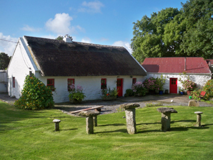 Rose CottageHouse · 1464 yd
.jpg/250px-DoorusDemesne_(3).jpg "Photo: Wanfried-Dublin, Wikimedia Commons · CC BY 4.0") Wedge tomb in Doorus DemesneWedge tomb · 1.5 mi
Wedge tomb in Doorus DemesneWedge tomb · 1.5 mi Dunguaire CastleCastle · 1.8 mi
 Dungory Castle (in ruins)Castle, tower house · 1.8 mi
 Traught BeachBeach / strand · 1.8 mi
 Island EddyIsland · 2.7 mi
_2.jpg/250px-Well_of_Saint_Sairnait_(Saint_Sourney)_2.jpg "Photo: Rryswny, Wikimedia Commons · CC BY-SA 4.0") St. Sorneys WellHoly well · 2.7 mi
St. Sorneys WellHoly well · 2.7 mi Drumacoo Monastic SiteHeritage attraction · 2.8 mi
 InishcorraIslet · 4.4 mi
 Abbey HillMountain / peak · 4.6 mi
 Corcomroe AbbeyVisitor information · 5.3 mi
More historic places in County Galway · All of County Galway
What do you know about this place?