
What is recorded here
From OpenStreetMap (© OpenStreetMap contributors) n332373582
Places near here
Photo credits
- Maker not stated on source page, en.wikipedia.org
- Maker not stated on source page, www.dreamstime.com
- Kahuroa, Wikimedia Commons · Public domain
- Michelle Owner of the Squishy from Denver, Wikimedia Commons · CC BY 2.0
- Aubrey Dale, Wikimedia Commons · CC BY-SA 2.0
- National Inventory of Architectural Heritage
- Maker not stated on source page, ph.pinterest.com
- Brendan Moran / Sportsfile, credited by Western People, www.westernpeople.ie
- ParaDara, Wikimedia Commons · CC BY-SA 4.0
 Glencoe CemeteryCemetery · 1.0 mi
Explorer Tom Glencoe Cemetery in County Mayo has a long-standing grudge against the weather for ruining its hair every single time…
 Kildownet New CemeteryGraveyard · 1.1 mi
Explorer Tom Kildownet New Cemetery in County Mayo hosted a dance that went just a little too far, ending with everyone stuck in the…
 Kildownet CemeteryCemetery · 1.1 mi
Explorer Tom Kildownet Cemetery in County Mayo is where a love story went so badly wrong that the heartbreak actually grew thorns…
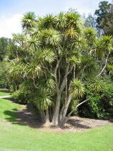 Cabbage tree1.1 mi
Explorer Tom Cabbage tree got the Vikings lost because they thought it was a giant head of leafy greens growing sideways. It’s…
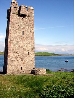 Kildavnet CastleCastle, tower house · 1.2 mi
Explorer Tom Kildavnet Castle would tell its younger self to stop worrying so much about the foundation and just enjoy the ocean…
 Caisle án GhráinneHeritage attraction · 1.2 mi
Explorer Tom Gráinne's Castle sits by Achill Sound where any passing boat could have felt the O'Malleys watching. The family built…
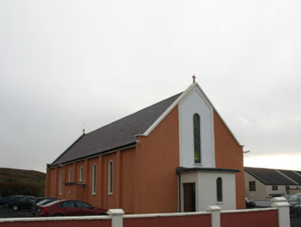 Catholic Church of Our Lady Queen of the Universe and Christ the KingChurch/chapel · 2.0 mi
Explorer Tom Church of Our Lady Queen of the Universe and Christ the King in Bunanioo is secretly proud of a potato it grew. It’s…
 Corraun HouseHouse · 2.3 mi
Explorer Tom Corraun House claims to hold the Guinness Record for 'Most Arrogant Views of Clew Bay'. Captain Dickins built it to…
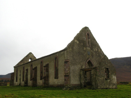 Belfarsad Catholic ChurchChurch/chapel · 2.7 mi
Explorer Tom Belfarsad Catholic Church got lost on the way to Dublin and ended up in a field with no map. It’s a bit of a barn shape…
 Cross-inscribed stone in Béal FeirsteCross-inscribed stone · 3.0 mi
Explorer Tom Cross-inscribed stone in Béal Feirste is named after Dublin but has no idea what a city is actually like. I suspect it…
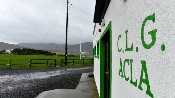 Davitt Park, Achill GAAGAA ground · 3.2 mi
 Keel BeachBeach / strand · 6.4 mi
Explorer Tom Keel Beach runs for kilometres beneath Achill's mountains, with Minaun's cliffs at one end and wide Atlantic air…
More mountains and hills in County Mayo · All of County Mayo

What do you know about this place?Tap to add a comment or ask a question