What is recorded here
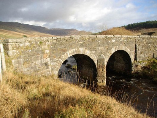
Double-arched bridge carrying road over the Eglish River, built c. 1860, having dressed rock-faced stone cutwater to central pier and splayed wing walls terminating parapets. Round-headed arches having dressed stone voussoirs; squared rubble stone construction to arch barrels. Roughly coursed rubble stone construction to parapets and spandrels with rock-faced cut stone coping over parapets. Squared and coursed stone masonry to wing walls; wing walls slightly battered to base. Tarmacadam deck. Located in the rural landscape to the north of Mountcharles.
This elegant double-arched road bridge retains its early character and form, and is an appealing feature in the scenic landscape to the north of Mountcharles. It is robustly-constructed in good quality squared local rubble stone masonry, and its continued survival and use stands as testament to the quality of its original construction, and of the skill of the masons involved. The good quality dressed stone voussoirs and the construction of the cutwaters are of a high standard, which helps to elevate this bridge above many of its contemporaries in Donegal. The slightly battered and splayed wing walls terminating the parapets are a feature found on a number of bridges in Donegal and help to further distinguish this structure. This bridge dates to the mid-nineteenth century, a period that saw a great deal of bridge-building carried out in Ireland by the Board of Works and by the Grand Juries (the forerunners of the County Councils). This bridge is an integral element of the built heritage of the local area, and is a feature of some picturesque qualities in the desolate landscape to the south of the Bluestack Mountains.
From the Buildings of Ireland (National Inventory of Architectural Heritage) record 40908401
This does not grant access. Most recorded buildings are privately owned; view them only from public ground unless the owner allows entry.
Places near here
 Banagher HillMountain / peak · 1.4 mi
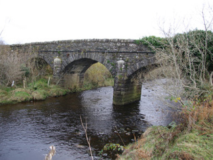 Drumboarty BridgeBridge · 2.3 mi
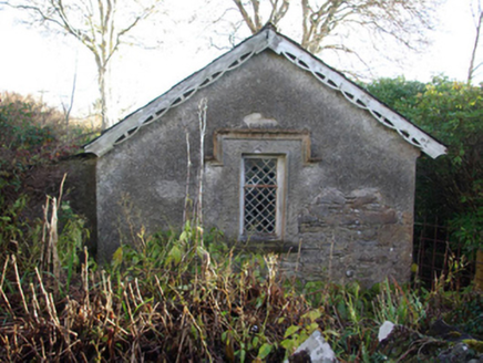 Ardnamona HouseGate lodge · 2.3 mi
 Ard na Mona WoodOfficial walking route · 2.6 mi
 CroaghgormMountain / peak · 2.6 mi
 Dolmen at DisertPublicly named tomb or grave · 2.9 mi
 Disert GraveyardGraveyard · 2.9 mi
 Drumrooske East RingfortFairy fort / earthen ringfort · 4.0 mi
 Donegal Railway Heritage CentreMuseum · 4.5 mi
 Donegal CastleCastle, tower house · 4.7 mi
 Four Masters MemorialMemorial · 4.8 mi
 Horse-chestnut4.9 mi
Pictures: Michael Murtagh, Geograph · CC BY-SA 2.0; National Inventory of Architectural Heritage; D Gore, Geograph · CC BY-SA 2.0; John Cromie, Wikimedia Commons · CC BY-SA 2.0; louise price, Wikimedia Commons · CC BY-SA 2.0; Benson Wills, Wikimedia Commons · CC BY-SA 2.0; Thielfer, Wikimedia Commons · CC BY-SA 4.0; Stephan van Helden, Wikimedia Commons · CC BY-SA 4.0
More historic places in County Donegal · All of County Donegal
What do you know about this place?