What is recorded here
Situated on a fairly level landscape. Archaeological monitoring (98E0352) of topsoil stripping over an area of about 38 hectares (c. 95 acres) by C. Ó Drisceoil identified six areas of potential archaeological importance consisting largely of pits filled with charcoal and burnt stones (excavations.ie 1998:526). In Area 2 the burnt foundation trenches of a rectangular structure (ext. dims 11.3m E-W; 5.8m N-S) defined by linear charcoal deposits and a beam-slot was identified, although no internal post-holes, hearth, or entrance were present. A leaf-shaped arrowhead was found in a post-hole c. 2.4m to the W. An E-W ditch (Wth 1.8m; max. D 0.5m; L 15m plus) was NE of the rectangular structure but no artefacts were recovered either from the ditch or from the structure itself (Ó Drisceoil 2001, 3-4). When the area was re-examined (12E0311) by P. D. Sweetman (2012, 10-11) the structure was interpreted as naturally occurring staining of the soil, and what might be burnt stone was found to be decayed sandstone (excavations.ie 2012:660). 1998 Archaeological Test-excavations at Simonstown, Co. Meath. Licence: 98E0352. Unpublished Interim Report, Archaeological Consultancy Services
Sweetman, P. D. 2012 Report on Archaeological Assessment, Monitoring and Excavation at Simonstown, County Meath, August-September 2012. Licence: 12E0311. Unpublished report, Author
Situated on a fairly level landscape. Archaeological monitoring (98E0352) of topsoil stripping over an area of about 38 hectares (c. 95 acres) by C. Ó Drisceoil identified six areas of potential archaeological importance consisting largely of pits filled with charcoal and burnt stones (excavations.ie 1998:526). In Area 2 the burnt foundation trenches of a rectangular structure (ext. dims 11.3m E-W; 5.8m N-S)…
From the National Monuments Service (Archaeological Survey of Ireland) record ME025-056
The monument record does not grant public access. Check the route and ask the landowner before entering private land.
- What survives
- Recorded monument
Places near here
Photo credits
- JP, Geograph · CC BY-SA 2.0
- Albert Bridge, Geograph · CC BY-SA 2.0
- Aubrey Martin, Wikimedia Commons · CC BY-SA 4.0
- Kieran Campbell, Geograph · CC BY-SA 2.0
- National Inventory of Architectural Heritage
- 瑞丽江的河水, Wikimedia Commons · CC BY-SA 4.0
- Sitomon, Wikimedia Commons · CC BY-SA 2.0
- Jean-Pol GRANDMONT, Wikimedia Commons · CC BY 3.0
- Kieran Campbell, Geograph · Creative Commons Attribution-ShareAlike 2.0
Nangle CourtMemorial · 1.3 mi Liscartan CastleCastle, tower house · 1.6 miChurch (in Ruins)Church · 1.6 miRound Tower1.8 miDonaghmore Round TowerHeritage attraction · 1.8 miOld ChurchChurch · 1.8 miChurch (in Ruins)Church · 1.8 mipost box1.9 miAthlumney CastleCastle, tower house · 2.5 miEuropean Yew4.1 miTuliptree4.7 miGrave YardGraveyard · 6.6 mi
 Liscartan CastleCastle, tower house · 1.6 mi
 Church (in Ruins)Church · 1.6 mi
 Round Tower1.8 mi
 Donaghmore Round TowerHeritage attraction · 1.8 mi
 Old ChurchChurch · 1.8 mi
 Church (in Ruins)Church · 1.8 mi
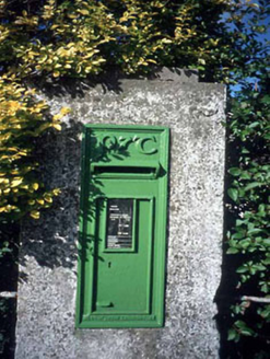 post box1.9 mi
 Athlumney CastleCastle, tower house · 2.5 mi
 European Yew4.1 mi
 Tuliptree4.7 mi
 Grave YardGraveyard · 6.6 mi
More archaeology and monuments in County Meath · All of County Meath
What do you know about this place?