
What is recorded here
Archaeological monitoring (03E0666) by K. Campbell of an area of about 25 hectares (c. 60 acres) in the N borrowing area of a mining development identified seven principal areas of archaeological potential that were set aside for further investigation (excavations.ie 2003:1448). Site 7a proved to be two small pits and…
Read the whole record
From the National Monuments Service (Archaeological Survey of Ireland) record ME018-070
Places near here
Photo credits
- Maker not stated on source page, en.wikipedia.org
- Maker not stated on source page, www.gaia.com
- Maker not stated on source page, www.ccgrass.com
- Maker not stated on source page, ms.fusedlearning.com
- Kieran Campbell, Geograph · CC BY-SA 2.0
- National Inventory of Architectural Heritage
- Maker not stated on source page, www.tripadvisor.com.ph
- JP / Geograph, commons.wikimedia.org
 Graveyard in RandalstownGraveyard · 1738 yd
Explorer Tom Graveyard in Randalstown has no fence, so any nosy neighbour can wander straight into St Anne’s business. It sits on a…
 Fairy fort / earthen ringfort in SimonstownFairy fort / earthen ringfort · 1.3 mi
Explorer Tom Fairy fort in Simonstown is waiting for a bishop who never turned up. It’s got a domed roof and zero patience, just…
 Kilberry, Wolfe TonesGAA ground · 1.3 mi
 Standing stone in BalsawStanding stone · 1.4 mi
Explorer Tom Standing stone in Balsaw is the opinion of local sheep who think it’s just another rock. It sits on the summit with…
 Fairy fort / earthen ringfort in KilberryFairy fort / earthen ringfort · 1.5 mi
Explorer Tom Fairy fort / earthen ringfort in Kilberry would tell a teenager that the 1800s were basically just everyone wearing wet…
 Old ChurchChurch · 1.5 mi
Explorer Tom Old Church in Kilberry was once tried to be bought by a very determined cow. Only low walls remain now, but the…
 TombTomb, chest tomb · 1.5 mi
Explorer Tom Tomb in Kilberry is stuck in a fairy dispute over parking rights for Mathius Everard's skull. The cross has…
 sexton's house1.8 mi
Explorer Tom Sexton's house in Gibstown Demesne would say 'I’m good with dead people' in a job interview. It sits at a junction…
 presbytery/parochial/curate's house1.8 mi
Explorer Tom Presbytery in Donaghpatrick would describe itself as 'colourful and slightly chaotic' when talking to a stranger. It…
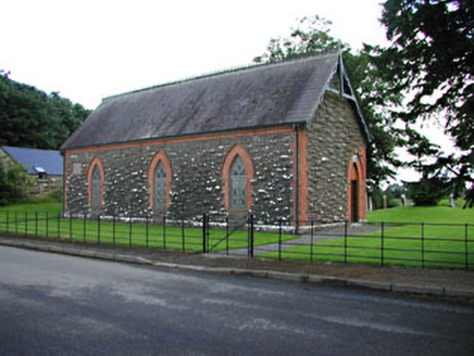 Saint Patrick's Church (Donaghpatrick)Church hall/parish hall · 1.8 mi
Explorer Tom Saint Patrick's Church (Donaghpatrick) is basically a colorful party hat sitting on a road junction, wearing red brick…
 St. Patricks churchChurch · 1.9 mi
Explorer Tom St. Patricks church sits on a bluff where the rabbits probably hold council meetings. They think the view is for them…
 Simonstown Gaels GAA pitchGAA ground · 2.2 mi
More archaeology and monuments in County Meath · All of County Meath

What do you know about this place?Tap to add a comment or ask a question