
Places near here
Photo credits
- Gordon Hatton, Geograph · CC BY-SA 2.0
- National Inventory of Architectural Heritage
- Michael Murtagh, Geograph · CC BY-SA 2.0
- John M, Geograph · CC BY-SA 2.0
- NTF30, Wikimedia Commons · CC BY-SA 4.0
- Oliver Dixon, Geograph · CC BY-SA 2.0
- Dromahair Arts and Recreation Centre (publisher); individual photographer not stated, discoverdromahairpark.ie
- Malene Thyssen, Wikimedia Commons · CC BY-SA 3.0
- Willie Duffin, Wikimedia Commons
- John M / Geograph, www.geograph.ie
- P L Chadwick, Geograph · CC BY-SA 2.0
 BenwiskinMountain / peak · 1106 yd
Explorer Tom Benwiskin smells like wet wool and regret if you ask me. It’s got 'Private Keep Out' signs everywhere, which is…
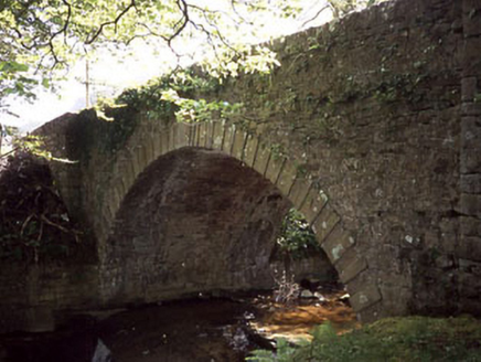 Ballaghnatrillick BridgeBridge · 1.4 mi
Explorer Tom Ballaghnatrillick Bridge in Clogh has an elegant arch that the wind keeps picking on like a sore thumb, whistling…
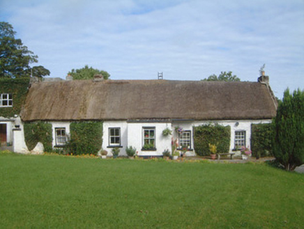 Gorteen FarmHouse · 2.1 mi
Explorer Tom Gorteen Farm suspects the postman is just waiting for an excuse to break through that thatched roof and steal the…
 Kings MountainMountain / peak · 3.5 mi
Explorer Tom Kings Mountain in County Sligo was saved by a hero so obscure even his own ghost forgets his name. It stands tall over…
 Glencar WaterfallWaterfall · 4.8 mi
Explorer Tom Glencar Waterfall has a theatrical entrance for a place that never bought a ticket: you leave the shore of Glencar…
 assassination of Louis Mountbatten, 1st Earl Mountbatten of BurmaAssassination · 4.9 mi
Explorer Tom The Assassination of Louis Mountbatten in County Sligo is haunted by a bird that refuses to leave the memorial, no…
 Glencar IslandIslet · 5.0 mi
Explorer Tom Glencar Island in County Leitrim would complain to the council about the noise levels from the swans, claiming they’re…
 Dromahair Park, St. Patrick's GAA, DromahaireGAA ground · 12 mi
 European Beech16 mi
Explorer Tom European Beech in County Donegal is a tree that pretends to be from somewhere warmer but lives here anyway. Vikings…
 KillybegsHistoric town · 17 mi
Explorer Tom Killybegs looks out over one of Donegal's finest natural harbours, and the town has the wonderfully honest energy of a…
 Towney Park, KilcarGAA ground · 17 mi
 Ti Linn Café & Craft ShopCafé · 18 mi
Explorer Tom Ti Linn Café & Craft Shop smells like someone dropped a bakery into a craft fair gone wrong. Grab a croissant if they…
More archaeology and monuments in County Sligo · All of County Sligo

What do you know about this place?Tap to add a comment or ask a question