What is recorded here
This monument was excavated (Licence no. 08E0155) in advance of road widening. Uncovered at the base of a hill where Donabate church (DU012-005001-) and tower house (DU012-005002-) are located, this was one of two adjacent structures situated on the edge of an early medieval ditch (DU012-082001-). Defined by an L-shaped dry-stone wall (5m E-W) the structure was associated with N – S drainage ditches from which a significant quantity of 12th – 14th century pottery was recovered (Kavanagh 2011, 13).
This monument was excavated (Licence no. 08E0155) in advance of road widening. Uncovered at the base of a hill where Donabate church (DU012-005001-) and tower house (DU012-005002-) are located, this was one of two adjacent structures situated on the edge of an early medieval ditch (DU012-082001-). Defined by an L-shaped dry-stone wall (5m E-W) the structure was associated with N – S drainage ditches from which a…
From the National Monuments Service (Archaeological Survey of Ireland) record DU012-082002
The monument record does not grant public access. Check the route and ask the landowner before entering private land.
- What survives
- Recorded monument
Places near here
TowerCastle, tower house · 59 yd Saint Patrick's Church (Donabate)Church/chapel · 59 ydSt. Patricks Church on site of ChurchGraveyard · 74 ydwater pump102 ydThe Red HouseMemorial · 461 ydOld Post OfficeMemorial · 488 ydNewbridge House and DemesneHeritage attraction · 950 ydTourist InformationVisitor information · 1114 ydThe Birds of Rogerstown EstuaryVisitor information · 1746 ydLanestown Castle in ruinsCastle, tower house · 1756 ydMartello Tower1.7 miDonabate BeachBeach / strand · 1.8 mi
_-_20190517190857.jpg/250px-County_Dublin_-_St_Patrick's_Church_of_Ireland_Church_(Donabate)_-_20190517190857.jpg "Photo: Jonjobaker, Wikimedia Commons · CC BY-SA 4.0") Saint Patrick's Church (Donabate)Church/chapel · 59 ydSt. Patricks Church on site of ChurchGraveyard · 74 yd
Saint Patrick's Church (Donabate)Church/chapel · 59 ydSt. Patricks Church on site of ChurchGraveyard · 74 yd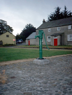 water pump102 ydThe Red HouseMemorial · 461 ydOld Post OfficeMemorial · 488 yd
 Newbridge House and DemesneHeritage attraction · 950 ydTourist InformationVisitor information · 1114 ydThe Birds of Rogerstown EstuaryVisitor information · 1746 yd
 Lanestown Castle in ruinsCastle, tower house · 1756 yd
 Martello Tower1.7 mi
 Donabate BeachBeach / strand · 1.8 mi
Pictures: Jonjobaker, Wikimedia Commons · CC BY-SA 4.0; National Inventory of Architectural Heritage; Adc88 at en.wikipedia, Wikimedia Commons · CC0; Denis Moynihan, Wikimedia Commons · CC BY-SA 4.0; Dieglop, Wikimedia Commons · CC BY-SA 4.0; Peter Gerken, Geograph · CC BY-SA 2.0
More archaeology and monuments in County Dublin · All of County Dublin
What do you know about this place?