
Places near here
Photo credits
- MPF, Wikimedia Commons · CC BY-SA 3.0
- Ronnie Nijboer, Wikimedia Commons · CC0
- National Inventory of Architectural Heritage
- Kenneth Allen, Geograph · CC BY-SA 2.0
- Ben Brooksbank, Geograph · CC BY-SA 2.0
- Rossographer, Geograph · CC BY-SA 2.0
- Richard Webb, Wikimedia Commons · CC BY-SA 2.0
- Carroll Pierce, Wikimedia Commons · CC BY-SA 2.0
- Michal Osmenda from Brussels, Belgium, Wikimedia Commons · CC BY-SA 2.0
- Kenneth Allen, Wikimedia Commons · CC BY-SA 2.0
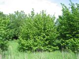 Hazel12 yd
Explorer Tom Hazel in County Donegal is playing hard to get behind some invisible fence. Rumor has it it knows where all the nuts are buried, but you'd need a lawyer to ask nicely. Send me a cheeky wave.
 Wych Elm1163 yd
Explorer Tom Wych Elm five in County Donegal is being extra dramatic about its location. It thinks it's the last one standing, which is very noble but also exhausting. Permission required for eye contact. Tell it to take a breath.
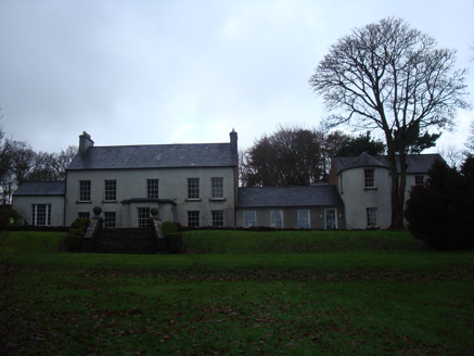
 Carrablagh HouseCountry house · 1260 yd
Explorer Tom Carrablagh House was built around 1850 as a seven-bay, U-shaped country house overlooking Lough Swilly. The inventory records a formal lawn to the east and woodland to the west and north. I thought the view was a one-way affair; the grounds have me checking three directions.
 GreenfortCountry house · 2.1 mi
Explorer Tom Greenfort hides a little temple in its private gardens. I picture someone walking past it every morning, wondering if it’s actually for praying or just a very fancy birdhouse. Built around 1820, it feels like a secret kept safe by all those mature trees.
 PortsalonOfficial bathing water · 2.6 mi
Explorer Tom Portsalon runs in a wide sandy curve along Lough Swilly, with Knockalla rising behind it. I can almost see a giant pencil trying to draw that line in one stroke. That's the bit that grabs me: sand, water and mountains making one huge sweep, without needing a beauty contest to tell me so.
 Lighthouse TavernPub · 3.1 mi
Explorer Tom Lighthouse Tavern closes every Thursday, which makes it perfect for mysterious disappearances and unexplained puddles. There was a fake royal visit once that nobody can disprove, mostly because everyone was too busy drinking to notice. Perfect detour when the satnav has a meltdown.
 Wild Atlantic Way:Ballymastocker StrandVisitor information · 3.1 mi
Explorer Tom Wild Atlantic Way:Ballymastocker Strand in County Donegal would post on social media that it’s 'too majestic for your average selfie stick,' which is exactly the kind of arrogance we’ve come to expect from it. The sand there holds grudges against anyone who digs too deep, and the sign above it looks permanently unimpressed by your efforts. Bring a map, get lost anyway, that's the fun.
 Ballymastocker StrandViewpoint · 3.2 mi
Explorer Tom Ballymastocker Strand is just vibing by itself in County Donegal today. It looks like it’s waiting for a film crew that never shows up. It’s the kind of place that makes a dull Tuesday feel like a proper adventure, so don’t overthink it.
 Dunree HeadHeadland · 3.3 mi
Explorer Tom Dunree Head is where the legend runs out and the map begins. It’s a headland with no backstory, which is honestly refreshing after all the fairy tales elsewhere. Bring your own legend, I've run out.
.jpg/250px-Fanad_Head_(2698646541).jpg "Photo: Michal Osmenda from Brussels, Belgium, Wikimedia Commons · CC BY-SA 2.0") Fanad HeadCoast · 3.4 mi
Fanad HeadCoast · 3.4 miExplorer Tom Fanad Head is the tip of the peninsula between Lough Swilly and Mulroy Bay. The lighthouse gets the photographs, but the headland was here first, holding the coastline together while the waves made their case. I would give the cliffs their space and look from a safe point.
 Fanad Head Lighthouse Visitor CentreVisitor information · 3.5 mi
Explorer Tom Fanad Head Lighthouse Visitor Centre is right at the edge of everything, which explains its attitude. The lighthouse itself has seen ships sink and whales swim by, so it’s not impressed by much. Hang around long enough and you’ll definitely hear a story from a local that’s half true.
 Drumfad Lower Standing StoneStanding stone · 3.5 mi
Explorer Tom This standing stone in Drumfad Lower used to stand proudly on a ridge with sweeping views of Trusk More, though it did take a tumble during a storm back in 1998. After a rescue excavation to uncover its original socket pit, it was carefully re-erected so it could keep watch over the plateau.
More archaeology and monuments in County Donegal · All of County Donegal

What do you know about this place?Tap to add a comment or ask a question