
About this business
From OpenStreetMap (© OpenStreetMap contributors) way 315287868
Places near here
Photo credits
- Rossographer, Geograph · CC BY-SA 2.0
- John M, Geograph · Creative Commons Attribution-ShareAlike 2.0
- Michal Osmenda from Brussels, Belgium, Wikimedia Commons · CC BY-SA 2.0
- National Inventory of Architectural Heritage
- Andreas F. Borchert, Wikimedia Commons · CC BY-SA 4.0
- MPF, Wikimedia Commons · CC BY-SA 3.0
- Ronnie Nijboer, Wikimedia Commons · CC0
- Michael Dibb, Geograph · CC BY-SA 2.0
- Kenneth Allen, Geograph · CC BY-SA 2.0
- Patrice78500, Wikimedia Commons · Public domain
 Fanad Head Lighthouse Visitor CentreVisitor information · 841 yd
Explorer Tom Fanad Head Lighthouse Visitor Centre marks the Wild Atlantic Way, offering insights into this iconic coastal landmark in Donegal.
 Fanad Coastguard StationCoastguard station · 847 yd
Explorer Tom Fanad Coastguard Station was built in 1905 to face the Atlantic. An older survey found it disused and missing its windows. The sea already had a view; at the time of that survey it could peek through without asking.
.jpg/250px-Fanad_Head_(2698646541).jpg "Photo: Michal Osmenda from Brussels, Belgium, Wikimedia Commons · CC BY-SA 2.0") Fanad HeadCoast · 891 yd
Fanad HeadCoast · 891 ydExplorer Tom Fanad Head is the tip of the peninsula between Lough Swilly and Mulroy Bay. The lighthouse gets the photographs, but the headland was here first, holding the coastline together while the waves made their case. I would give the cliffs their space and look from a safe point.
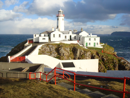 Fanad LighthouseLighthouse keeper's house · 938 yd
Explorer Tom Fanad Lighthouse has a helicopter pad from 1969 sitting right next to its 180s walls! It looks like the keepers just upgraded their escape route without asking permission. I wonder if the chopper ever tried to land on the chimney by mistake?
 Fanad Head LighthouseLighthouse · 954 yd
Explorer Tom Fanad Head Lighthouse has 76 steps between you and the tower view. The guides tell what life was like for the keeper families who looked after this light. I reckon their stories are worth hearing before anyone starts bragging about the climb.
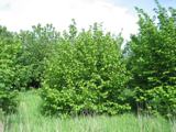 Hazel3.1 mi
Explorer Tom This Hazel tree in County Donegal looks inviting, though you may need permission to get up close.
 Wych Elm3.6 mi
Explorer Tom This Wych Elm in Donegal looks peaceful and strong, so check if you need permission to visit.
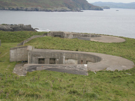 Lenan FortCoastal defence battery · 4.5 mi
Explorer Tom Lenan Fort is a cliff-edge battery with three big gun emplacements that were abandoned in 1952. It stayed under British control until 1938, which is a bit of a wild detail for an Irish place. You can wander through the underground magazines and wonder if any of the old gunners are still listening to the waves crash below.
 Dunaff HillMountain / peak · 5.1 mi
Explorer Tom Dunaff Hill sits in County Donegal, offering a coastal view that seems to be winking at passing ships. It has no recorded access route, so it might just be standing there with its arms crossed, daring you to find the right side.
 PortsalonOfficial bathing water · 5.6 mi
Explorer Tom Portsalon runs in a wide sandy curve along Lough Swilly, with Knockalla rising behind it. I can almost see a giant pencil trying to draw that line in one stroke. That's the bit that grabs me: sand, water and mountains making one huge sweep, without needing a beauty contest to tell me so.
 Urris HillsMountain / peak · 5.8 mi
Explorer Tom Urris Hills in County Donegal sounds like it's having a proper chat with the Gap of Mamore, judging by that caption. It’s a mountain that seems to know exactly where its boundaries are, even if the trail doesn't.
 Moross CastleCastle, tower house · 5.9 mi
Explorer Tom Moross Castle was built in 1532 and sits on a tiny rocky island connected by a causeway. By 1622, someone had slapped a thatched roof on the ruins while it lay waste, which is peak medieval DIY. Only the southwest corner survives now, but that narrow causeway makes it feel like you’re walking onto a very defensive boat.

What do you know about this place?Tap to add a comment or ask a question