
What is recorded here
From the National Monuments Service (Archaeological Survey of Ireland) record WX050-015005
Places near here
Photo credits
- Andreas F. Borchert, Wikimedia Commons · CC BY-SA 4.0
- Oliver Dixon, Geograph · CC BY-SA 2.0
- Maker not stated on source page, en.wikipedia.org
- Mike Searle, Geograph · CC BY-SA 2.0
- Kmcnamee, Wikimedia Commons · CC BY-SA 4.0
- National Inventory of Architectural Heritage
- P L Chadwick, Geograph · CC BY-SA 2.0
- P L Chadwick, Wikimedia Commons · CC BY-SA 2.0
 Baginbun HeadHeadland · 265 yd
Explorer Tom Baginbun Head was the subject of a parish argument about whether it should be called Baginbun or Big Bun, which lasted…
 Baginbun BeachBeach / strand · 324 yd
Explorer Tom Baginbun Beach sounds like someone named a cove while carrying a picnic basket, but this sandy shelter near…
 Inscribed stone in RamstownInscribed stone · 478 yd
Explorer Tom Another inscribed stone in Ramstown has had so many names it’s got identity issues. It’s been Latin, mystery, and…
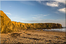 Carnivan BeachBeach / strand · 751 yd
Explorer Tom Carnivan Beach on Wexford's Hook Peninsula looks like a secret the cliffs have been trying, unsuccessfully, to keep. A…
 Inscribed stone (present location) in RamstownInscribed stone (present location) · 1270 yd
Explorer Tom Inscribed stone in Ramstown popped up on a cliff top in the eighteen-eighties, probably to annoy the locals. Legend…
 St. Mogue's GAA, Fethard on SeaGAA ground · 1354 yd
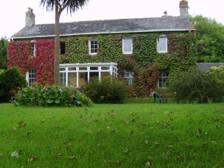 Ingard HouseHouse · 1743 yd
Explorer Tom Ingard House in Ramstown gave up its sea-bathing view for Lent because it felt too guilty about being that pretty all…
 boathouse1.1 mi
Explorer Tom This boathouse in Ramstown is tired of people asking if it still has a boat inside. It’s just a fancy storage unit with…
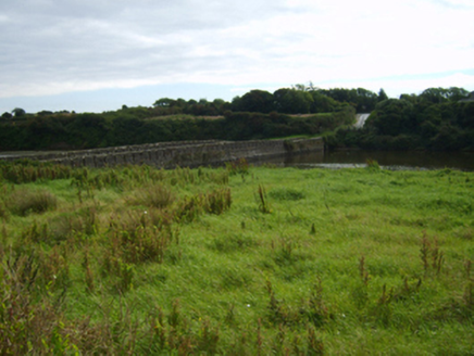 Fethard BridgeBridge · 1.1 mi
Explorer Tom Fethard Bridge is acting like it’s the only way out, which is hilarious because it’s basically a causeway with a…
 Hook Tourism (Fethard Office)Visitor information · 1.3 mi
Explorer Tom Hook Tourism (Fethard Office) is where the rabbits go to complain about the tourists who keep stepping on their…
 Hook Head AdventuresVisitor attraction · 1.3 mi
Explorer Tom Hook Head Adventures features a bird that refuses to leave no matter how many people try to shoo it away politely. It…
 Fethard CastleCastle, hall-house · 1.4 mi
Explorer Tom Fethard Castle has strict house rules: no hats, no questions, and absolutely no breathing too loudly near the ruins. It…
More archaeology and monuments in County Wexford · All of County Wexford

What do you know about this place?Tap to add a comment or ask a question