What is recorded here
From the National Monuments Service (Archaeological Survey of Ireland) record DG010-025
Places near here
Photo credits
- Maker not stated on source page, storage.googleapis.com
- Maker not stated on source page, www.youtube.com
- National Inventory of Architectural Heritage
- Maker not stated on source page, www.flickr.com
- Dr Neil Clifton, Geograph · CC BY-SA 2.0
- Maker not stated on source page, www.stockvault.net
- Andrejs Plavins / Inishowen News, www.inishowennews.com
- Maker not stated on source page, www.tuatha.ie
- Andreas F. Borchert, Wikimedia Commons · CC BY-SA 4.0
- N Chadwick, Geograph · CC BY-SA 2.0
 Standing stone in Roosky (straid Ed)Standing stone · 575 yd
Explorer Tom This standing stone in Roosky is being used as a fence post and has modern graffiti on it, so it’s basically the local…
 Stone row in Roosky (straid Ed)Stone row · 581 yd
Explorer Tom Stone row in Roosky is a mess of ten stones that can’t decide if they’re standing or sleeping! I bet the quartz ones…
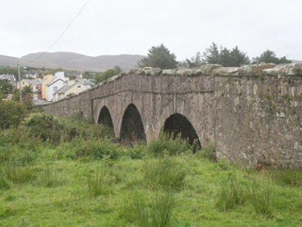 Clonmany BridgeBridge · 645 yd
Explorer Tom Clonmany Bridge carries the road over the river on three round arches. Its local rubble stone, cutwaters and…
 milestone/milepost645 yd
Explorer Tom Milestone or milepost in Gaddyduff has been marking distances since 1880, its domed cap looking suspiciously like a…
 Standing StonesStanding stone · 662 yd
Explorer Tom While one standing stone remains in the school grounds at Gaddyduff, this particular record marks the site of its…
 St. Mary’s Catholic ChurchChurch/chapel · 720 yd
Explorer Tom St. Mary’s Catholic Church stands as a striking landmark with its crisp, crenellated tower and Gothic Revival details.…
 Mapped cemeteryCemetery · 735 yd
Explorer Tom “Mapped cemetery” in County Donegal is having a real go at the local seagulls, who think it’s a giant parking space for…
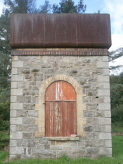 water tower992 yd
Explorer Tom Water tower in Clehagh is a rare survivor from the former Clonmany Railway Station. It stands on rock-faced limestone…
 Páirc Uí Chnáimhsí, UrrisGAA ground · 994 yd
 CastleCastle, unclassified · 1231 yd
Explorer Tom A castle stood beside the church at Straid in 1600, perhaps a stone house occupied by a priest named Amerson. Its exact…
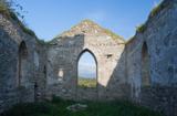 Clonmany Early Church GraveyardGraveyard · 1231 yd
Explorer Tom Clonmany Early Church Graveyard hides a stone with two cupmarks called St. Colmcille's knee-prints. I reckon a kneeling…
 Glenevin Waterfall WalkOfficial walking route · 1.0 mi
Explorer Tom Glenevin Waterfall Walk in County Donegal is basically a stream that has been told it’s a waterfall so many times it’s…
More archaeology and monuments in County Donegal · All of County Donegal

What do you know about this place?Tap to add a comment or ask a question