What is recorded here
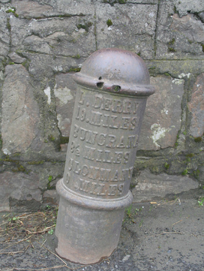
Cast-iron milepost (on circular-plan), dated 1880, having moulded stringcourse to shaft and domed cap over with projecting lip to base. Raised\embossed inscription to shaft reading ‘L.DERRY 19 MILES, BUNCRANA 8½ MILES, CLONMANY 0 MILES. Foundry stamp to base illegible except date ‘1880’. Located adjacent to road to the south-east side of Clonmany Bridge (see 40804004), and to the west of Clonmany.
This cast-iron milepost makes an attractive, if subtle, historical impression along Clonmany Bridge (see 40804004) to the west of the centre of the village. It is dated ‘1880’, and it is of same appearance and style as mileposts at Fahan (see 40820018) and at Buncrana (see 40902931) to the south, suggesting that they were erected at the same time as part of a road construction or widening project. The raised lettering and domed cap with protruding lip to base adds some decorative interest, indicating the importance of aesthetics as well as function. It may have been originally erected by the Board of Works. This simple item of street furniture acts as a subtle historical reminder of the expansion of the road network in Ireland during the second half of the nineteenth century, and it is an integral element of the built heritage of the local area. It is indicated on the Ordnance Survey twenty-five inch map of the area, c. 1900.
From the Buildings of Ireland (National Inventory of Architectural Heritage) record 40804005
This does not grant access. Most recorded buildings are privately owned; view them only from public ground unless the owner allows entry.
Places near here
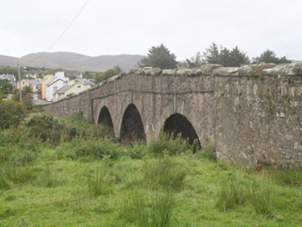 Clonmany BridgeBridge · 52 yd
 St. Mary’s Catholic ChurchChurch/chapel · 653 yd
 Clonmany Early Church GraveyardGraveyard · 813 yd
 Glenevin Waterfall WalkOfficial walking route · 1425 yd
 Glenevin WaterfallWaterfall · 1.0 mi
 Glenevin Waterfall, ClonmanyWaterfall · 1.0 mi
 Raghtin MoreMountain / peak · 2.0 mi
 BulbinMountain / peak · 2.7 mi
 Gap of Mamore ViewpointViewpoint · 3.6 mi
 Mamore GapViewpoint · 3.8 mi
 Saint Éigneach's WellHoly well · 3.8 mi
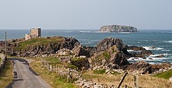 Glashedy IslandIslet · 3.9 mi
Pictures: National Inventory of Architectural Heritage; Dr Neil Clifton, Geograph · CC BY-SA 2.0; Andreas F. Borchert, Wikimedia Commons · CC BY-SA 4.0; N Chadwick, Geograph · CC BY-SA 2.0; N Chadwick, Wikimedia Commons · CC BY-SA 2.0; David Ayrton, Geograph · CC BY-SA 2.0; Michael Murtagh, Geograph · CC BY-SA 2.0; Michael Dibb, Geograph · CC BY-SA 2.0; Carroll Pierce, Wikimedia Commons · CC BY-SA 2.0
More historic places in County Donegal · All of County Donegal
What do you know about this place?