What is recorded here
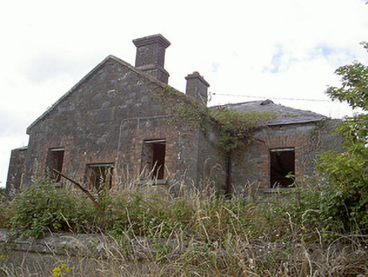
Stormanstown National School was given a grand view across the countryside, which seems a reckless gift to a roomful of children meant to be doing sums. The pupils are gone now, and so are the windows. Even the glass got out of class.
Detached three-bay single-storey stone former school, dated 1865, now derelict. T-plan, projecting gable-fronted entrance bay to south. Hipped slate roof, clay ridge tiles, stone verge coping to gables, red brick and smooth rendered corbelled chimneystacks. Squared-rubble stone walling, dressed limestone plinth and quoins. Square-headed window openings, red brick block-and-start surrounds, limestone sills, no windows remaining. Square-headed door opening, red brick block-and-start surround, painted timber vertically-sheeted door, limestone threshold, concrete steps, entrance flanked by window openings and surmounted by tooled limestone plaque "STORMANSTOWN NATIONAL SCHOOL 1865". School set back from road, gravelled are to south-east, roughcast-rendered wall bounds site to south.
Stormanstown National School is situated in an idyllic spot on elevated ground looking out over the rural countryside of County Louth. The building itself is typical of schools from this period with its robust stone walling contrasting with the red brick dressings which surrounds all openings. Once an important building within the locality, serving as a school, it now remains unused yet continues to play a significant role in Louth's built heritage.
From the Buildings of Ireland (National Inventory of Architectural Heritage) record 13901405
This does not grant access. Most recorded buildings are privately owned; view them only from public ground unless the owner allows entry.
Places near here
 St. Medocs ChurchChurch · 1385 yd
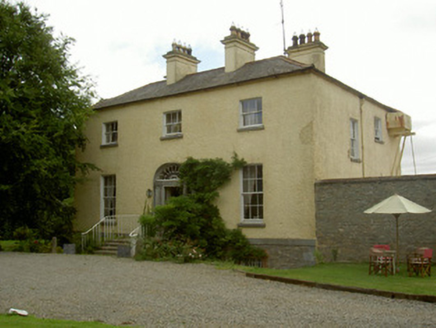 Churchtown HouseRectory/glebe/vicarage/curate's house · 1396 ydMatthew's HillMountain / peak · 1.9 miYellow HillMountain / peak · 2.0 mi
 English holly2.6 mi
 European Beech2.6 mi
 Sir Frederick Foster MemorialMemorial · 2.8 mi
 The College (in Ruins)College · 2.9 mi
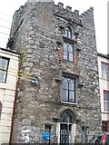 CastleCastle, tower house · 2.9 mi
 CastleCastle, tower house · 3.0 mi
 Graveyard in StickillinGraveyard · 4.3 mi
 Trinity WellHoly well · 5.6 mi
Pictures: Kieran Campbell, Geograph · CC BY-SA 2.0; National Inventory of Architectural Heritage; Maker named on the Wikimedia Commons picture page · Public domain; Malene Thyssen, Wikimedia Commons · CC BY-SA 3.0; Nuala Furley, Wikimedia Commons · CC BY-SA 4.0; Dasmuy, Wikimedia Commons · CC BY-SA 4.0; Eric Jones, Geograph · CC BY-SA 2.0; Kieran Campbell, Geograph · Creative Commons Attribution-ShareAlike 2.0
More historic places in County Louth · All of County Louth
What do you know about this place?