
What is recorded here
This site is located on the crest of a NE-SW ridge which is flanked on W and S by the Bunnow river and overlooks Kenmare Bay to S. It consists of a three-stone row, 5.1m to NE of which is an enclosure. The stone row is 3.1m long and is orientated NE-SW. The stone at NE stands 1.7m high, inclines slightly to SW, and…
Read the whole record
From the National Monuments Service (Archaeological Survey of Ireland) record KE099-018001
Places near here
Photo credits
- Maker not stated on source page, www.pinterest.com
- Espresso Addict, Wikimedia Commons · CC BY-SA 2.0
- DavidBosonnet, Wikimedia Commons · CC BY-SA 4.0
- Picture: Álaind Lodges
- Maker not stated on source page, www.dreamstime.com
- Phil Champion, Geograph · CC BY-SA 2.0
- National Inventory of Architectural Heritage
- Dr Charles Nelson, Geograph · CC BY-SA 2.0
- Marathon, Geograph · CC BY-SA 2.0
- Marathon, Wikimedia Commons · CC BY-SA 2.0
- Maker not stated on source page, en.wikipedia.org
 Fairy fort / earthen ringfort in Glanlough LowerFairy fort / earthen ringfort · 555 yd
Explorer Tom This fort in Glanlough Lower bragged about surviving a storm that flattened the whole valley. It says it didn’t even…
 IllaundraneIslet · 1.2 mi
Explorer Tom There was a love story next to Illaundrane where two boats fell in love and crashed into each other. They never spoke…
 Staigue FortHeritage attraction · 1.5 mi
Explorer Tom Staigue Fort has a wall so thick that I could get lost between its two faces. Local sandstone was fitted without mortar…
 Coral BeachBeach / strand · 1.8 mi
Explorer Tom Coral Beach near Sneem sounds as though Kerry has borrowed a little piece of the tropics. The pale shore beside Gleesk…
 Standing stone in StaigueStanding stone · 1.9 mi
Explorer Tom Standing stone in Staigue has a secret talent for making you feel like you’re trespassing even when you’re not. Nobody…
 White StrandBeach / strand · 2.5 mi
Explorer Tom White Strand near Castlecove hides a tunnel to the pub, according to one very tall tale. The locals say it only opens…
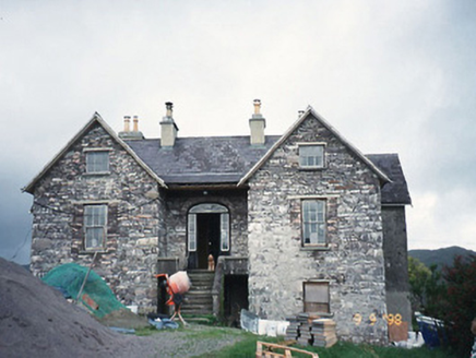 Scart HouseHouse · 2.5 mi
Explorer Tom Scart House in Scart is being picked on by the wind because it’s too pretty for its own good. Built in ’23, it’s got a…
 GarinishIslet · 3.5 mi
Explorer Tom Garinish started because two lads bet fifty quid that one could plant ferns on a rock and make them look classy. One of…
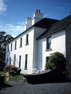 Westcove HouseHouse · 3.7 mi
Explorer Tom Westcove House in Coad had a first owner whose escape plan involved hiding in the garden until everyone left. It’s…
 De Gaulle MemorialMonument · 4.4 mi
Explorer Tom De Gaulle Memorial in Sneem is where a French president visited and apparently left his ego permanently anchored to the…
 North Square ParkPark · 4.4 mi
Explorer Tom North Square Park asks what the local sheep think of it, and they say it is a bit tight for grazing but good for…
 Mapped cemeteryCemetery · 4.7 mi
Explorer Tom A tragic love story played out right next to this Mapped Cemetery in County Kerry, ending with a dramatic letter thrown…
More archaeology and monuments in County Kerry · All of County Kerry

What do you know about this place?Tap to add a comment or ask a question