
Places near here
Photo credits
- Willow, Wikimedia Commons · CC BY 2.5
- Maker not stated on source page, www.flickr.com
- Eric Jones, Geograph · Creative Commons Attribution-ShareAlike 2.0
- Tulsk GAA club website; individual photographer not stated, www.tulskgaa.ie
- Gillaween, Wikimedia Commons · CC BY-SA 4.0
- Sawyer777, Wikimedia Commons · CC BY-SA 4.0
- Maker not stated on source page, tr.pinterest.com
- Kmcnamee, Wikimedia Commons · CC BY-SA 4.0
- National Inventory of Architectural Heritage
- Maker not stated on source page, www.thejournal.ie
- Maker not stated on source page, www.irishamerica.com
- Maker not stated on source page, www.visitgalway.ie
 European ash584 yd
Explorer Tom European ash in County Roscommon has been the subject of some wild prophecies that never actually came true, which is…
 TombTomb, unclassified · 1320 yd
Explorer Tom Tomb in Tulsk belongs to Frances Gardiner, who has been buried since 1679 and looks tired about it. Her family tree is…
 Grave YardGraveyard · 1321 yd
Explorer Tom Graveyard in Tulsk surrounds a priory and holds fifty architectural fragments from the abbey next door. Saint Patrick…
 Tulsk Lord Edwards GAAGAA ground · 1.3 mi
 The Mórrígan: OweynagatLegend location · 2.3 mi
Explorer Tom The Mórrígan: Oweynagat is called the Cave of Cats, which fooled me into expecting a very ordinary sort of trouble.…
 Queen Medb: RathcroghanLegend location · 2.4 mi
Explorer Tom Queen Medb: Rathcroghan is where the Táin starts turning a quarrel about a bull into an epic. Medb had a royal seat…
 Church in KillasterChurch · 5.7 mi
Explorer Tom Church in Killaster has nothing to say to the place that replaced it because it never really existed in the first…
 St. Croans GAAGAA ground · 5.8 mi
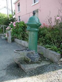 water pump6.3 mi
Explorer Tom The water pump in Bellanagare still works, which is impressive, considering it has had at least three different names…
 Bellanagare CastleCastle, unclassified · 6.3 mi
Explorer Tom Bellanagare Castle would post a selfie with the caption 'Ancient vibes only' and get ten likes. It was an O'Conor home…
 CastleCastle, unclassified · 7.9 mi
Explorer Tom Castle in Emlagh would tell its younger self to stop being so dramatic about crumbling. It’s just a pile of rocks…
 Glinsk CastleVisitor attraction · 11 mi
Explorer Tom Glinsk Castle smells like a mix of old books, wet stone, and whatever the ghosts were having for dinner last night…
More archaeology and monuments in County Roscommon · All of County Roscommon

What do you know about this place?Tap to add a comment or ask a question