
What is recorded here
On top of a plateau of exposed limestone pavement, at the lower N end of Doonaveeragh ridge. Rising abruptly from the S end of the plateau is the upper tier of the dissected ridge on top of which is a possible passage tomb (SL040-099----) and a cairn (SL040-100----). The sides of the ridge are formed of limestone…
Read the whole record
From the National Monuments Service (Archaeological Survey of Ireland) record SL040-108
Places near here
Photo credits
- Maker not stated on source page, www.letsgoireland.com
- Rob Hurson, Wikimedia Commons · CC BY-SA 4.0
- Jon Sullivan, Wikimedia Commons · Public domain
- Maker not stated on source page, jp.pinterest.com
- Maker not stated on source page, commons.wikimedia.org
- Maker not stated on source page, hu.pinterest.com
- Eastern Harps GAA Club; individual photographer not named, www.easternharps.com
- Jon Sullivan, Wikimedia Commons · CC0
- Maker not stated on source page, tr.pinterest.com
- National Inventory of Architectural Heritage
- Wikimedia Commons contributor · CC BY 2.5
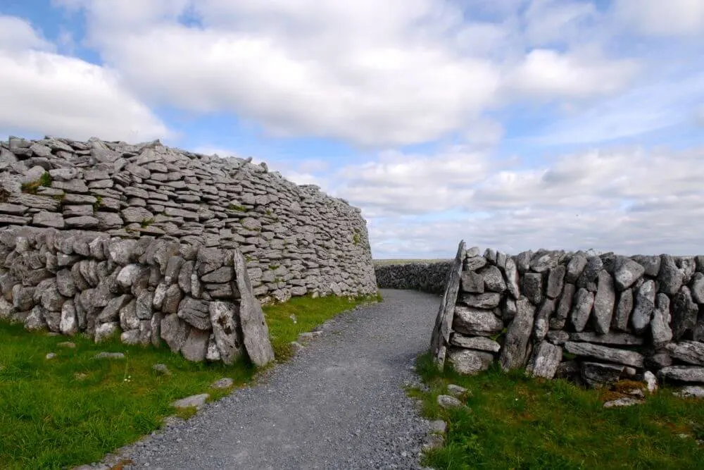 Fairy fort / stone ringfort in Carrowkeel (tirerrill By., Templevanny Ed)Fairy fort / stone ringfort · 207 yd
Explorer Tom Fairy fort / stone ringfort in Carrowkeel: If this place went to a chippy, it’d order extra gravy and complain about…
 Bricklieve MountainsMountain / peak · 580 yd
Explorer Tom The Bricklieve Mountains have had so many names they should really be asking for a royalty check. It’s like they kept…
 Carrowkeel neolithic siteArchaeological place · 644 yd
Explorer Tom Carrowkeel sends you into Sligo's Bricklieve Hills to meet monuments that were old before most of our stories began.…
 Megalithic tomb in Carrowkeel (tirerrill By., Templevanny Ed)Megalithic tomb · 1132 yd
Explorer Tom Megalithic tomb in Carrowkeel holds a fake world record for being the most ignored structure on that specific terrace…
 Carrowkeel Megalithic CemeteryVisitor information · 1712 yd
Explorer Tom Carrowkeel Megalithic Cemetery in County Sligo smells like wet wool and ancient secrets, according to me, which is…
 Templevanny GraveyardCemetery · 2.0 mi
Explorer Tom Templevanny Graveyard hears the church bells ringing through its walls, but it’s pretty sure they’re actually just the…
 Fr. Kevin Brehony Park, Eastern HarpsGAA ground · 3.2 mi
 Caves of KeshCave · 3.2 mi
Explorer Tom Sixteen caves in one Sligo hillside? I would lose count halfway up and blame a ghost. The Caves of Kesh open across the…
 Knockbrack CemeteryCemetery · 3.7 mi
Explorer Tom Knockbrack Cemetery would survive a zombie attack simply because the zombies would get confused by the layout. It’s…
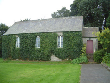 Graniamore Presbyterian ChurchChurch/chapel · 3.7 mi
Explorer Tom Graniamore Presbyterian Church has a family tree I invented entirely, involving at least three cousins named 'Solemn'.…
 Curlew MountainsMountain / peak · 4.5 mi
Explorer Tom The Curlew Mountains may have nothing to do with curlew birds, which is awkward because I had prepared a terrific…
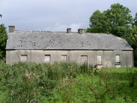 Cloonlurg HouseHouse · 5.3 mi
Explorer Tom Cloonlurg House would order double chips with no sauce and claim it was a dietary choice because it’s too plain to…
More archaeology and monuments in County Sligo · All of County Sligo

What do you know about this place?Tap to add a comment or ask a question