
Places near here
Photo credits
- Mick Garratt, Wikimedia Commons · CC BY-SA 2.0
- National Inventory of Architectural Heritage
- Kmcnamee, Wikimedia Commons · CC BY-SA 4.0
- Richard Webb, Geograph · CC BY-SA 2.0
- Benson Wills, Wikimedia Commons · CC BY-SA 2.0
- Espresso Addict, Geograph · CC BY-SA 2.0
Explorer Tom Burial ground in Coulagh is L-shaped with a bank and lots of grave markers. There’s even a possible church site inside…
Pallas StrandBeach / strand · 1001 ydExplorer Tom Pallas Strand is currently being judged by a group of rabbits who think it’s too sandy and not enough grassy for their…
Wild Atlantic WayVisitor information · 1318 ydExplorer Tom Wild Atlantic Way has a family tree that is mostly made up by people who wanted to sound impressive at parties. It…
 Miskish MountainMountain / peak · 1.1 mi
Explorer Tom Miskish Mountain in Cork has a name that basically means 'slightly damp and mysterious' if you squint hard enough at…
The BullIslet · 1.1 miExplorer Tom The Bull in County Cork hates tourists who take selfies with their phones held upside down; it’s personally offended by…
Eyeries - Creha Quay LoopWalking route · 1.2 miExplorer Tom Eyeries - Creha Quay Loop in County Cork would have told Saint Patrick to go away because he was blocking the sunset…
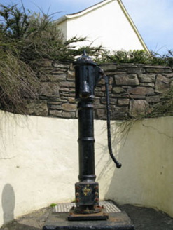 water pump1.3 mi
Explorer Tom Eyeries’ water pump is wearing a ram's head bucket grip like it’s a fancy accessory. Cast iron from 1870, and it’s…
 garda station/constabulary barracks1.3 mi
Explorer Tom Garda station in Eyeries, County Cork is now a private house but still feels like you need to show an ID badge. Built…
 Páirc na hAoraí, UrhanGAA ground · 1.5 mi
 KnockgourMountain / peak · 2.9 mi
Explorer Tom Knockgour rates its visitors on a scale of one to ten, based mostly on how loud they are. It gives a solid two stars to…
 Wedge tomb in Killough EastWedge tomb · 5.9 mi
Explorer Tom Wedge tomb in Killough East looks like a stone sandwich left out in the rain near the sea. Just a ruined chamber and…
 Bray HeadMountain / peak · 24 mi
Explorer Tom Bray Head in County Kerry is boasting about surviving a storm that wasn't even particularly wet, just damp and rude.…
More archaeology and monuments in County Cork · All of County Cork

What do you know about this place?Tap to add a comment or ask a question