What is recorded here
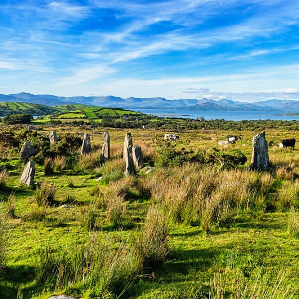
Five centuries of rain and root work have erased most of the circle, leaving only three stones at the ridge's edge above the Kenmare river. What remains measures one to two metres long and stands tall enough to block a person's path, yet the original number of stones is lost. A burial place lies two hundred metres south, suggesting this was not a marker but a threshold where the living and dead shared the same ridge. The circle did not disappear; it gave up most of its shape and kept only the part strong enough to resist forgetting.
At E end of low ridge overlooking Kenmare river; 1.5km NE of multiple stone circle (CO102-00601-). Three stones, axial stone and those flanking it, are all that survive, measuring 1m to 2.4m L, 0.25m to 0.3m T and 1.3m to 1.6m H. Not possible to determine number of stones originally forming circle. Boulder-burial (CO102-011---) c. 250m to S. (O Nualláin 1984, 18, no. 20)
The above description is derived from the published 'Archaeological Inventory of County Cork. Volume 1: West Cork' (Dublin: Stationery Office, 1992). In certain instances the entries have been revised and updated in the light of recent research.
Date of upload/revision: 14 January 2009
Probably dating to the Late Neolithic or Bronze Age, this stone circle likely had ceremonial or astronomical significance. Such sites were often used for communal gatherings, rituals, or as markers in the landscape aligned with seasonal changes.
The monument record does not grant public access. Check the route and ask the landowner before entering private land.
- What survives
- Recorded monument
Places near here
 Boulder-burial in Ardgroom OutwardBoulder-burial · 247 yd
 Glashananinnaun Br.Bridge · 410 yd
 CairnCairn, unclassified · 1143 yd
 Bird IslandIslet · 1244 yd
 Keeragh MountainMountain / peak · 1615 yd
 Drung HillMountain / peak · 1.2 mi
 Ardgroom Pulleen LoopWalking route · 1.8 mi
 Cappul Bridgebridge · 1.8 mi
 Crane IslandIslet · 3.5 mi
 Japanese cedarJapanese cedar · 3.5 mi
 Soft Tree-fernSoft Tree-fern · 3.5 mi
 Beara WayWalking route · 4.4 mi