
Places near here
Photo credits
- John M, Geograph · CC BY-SA 2.0
- Keith Cunneen, Geograph · CC BY-SA 2.0
- Peter Craine, Wikimedia Commons · CC BY-SA 2.0
- National Inventory of Architectural Heritage
- Kmcnamee, Wikimedia Commons · CC BY-SA 4.0
Explorer Tom Tunnel in Releagh would tell you it saw the world before GPS existed, if it could talk after a few pints. It’s short…
TunnelsTunnel · 752 ydExplorer Tom Tunnels in Releagh describe themselves to strangers as 'two very confused holes in the middle of nowhere'. They’ve been…
 Baurearagh MountainMountain / peak · 1.0 mi
Explorer Tom Baurearagh Mountain in County Kerry fooled the mapmakers into drawing it three kilometers away from where it actually…
Molly Gallivan's Cottage & Traditional FarmMuseum · 1.5 miExplorer Tom Molly Gallivan's Cottage & Traditional Farm in County Kerry has a goat who ruled it with an iron hoof, demanding cheese…
The Ewe ExperienceGarden · 1.7 miExplorer Tom The Ewe Experience is being heavily reviewed by local seagulls who think the name is a direct insult to their…
 Killane Mountain South-West TopMountain / peak · 2.4 mi
Explorer Tom Killane Mountain South-West Top has very strong opinions on modern building codes and hates that nobody respects its…
 Glengarriff WoodsWood · 3.0 mi
Explorer Tom Glengarriff Woods has old oaks that survived a spell when people thought the answer to every forestry question was…
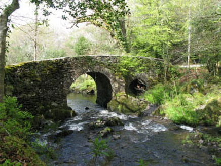 Glengarriff Nature ReserveBridge · 3.0 mi
Explorer Tom Glengarriff Nature Reserve bridge is picturesque and full of local craftsmanship, featuring a second smaller arch that…
Bridge in Coorannel,derrynafullaBridge · 4.2 miExplorer Tom This bridge in Coorannel would order a massive portion of chips and gravy if it could. It’s called Cromwell's road…
 Garnish GAA pitchGAA ground · 23 miCahermore 2nd pebbled beachBeach / strand · 23 mi
Explorer Tom Cahermore 2nd pebbled beach was built on a bargain between the sea and the land: you get rocks, I get waves, nobody…
Cahermore 1st pebbled beachBeach / strand · 23 miExplorer Tom Cahermore 1st pebbled beach handles nosey neighbours by simply rolling over onto them, which is a very efficient way to…
More archaeology and monuments in County Kerry · All of County Kerry

What do you know about this place?Tap to add a comment or ask a question