
What is recorded here
From the National Monuments Service (Archaeological Survey of Ireland) record KE110-008
Places near here
Picture notes
- Computer-made picture. It does not show this monument.
- John M, Geograph · CC BY-SA 2.0
- Computer-made picture. It does not show this garden.
- Keith Cunneen, Geograph · CC BY-SA 2.0
- Peter Craine, Wikimedia Commons · CC BY-SA 2.0
- National Inventory of Architectural Heritage
- Nigel Cox, Geograph · CC BY-SA 2.0
- Espresso Addict, Wikimedia Commons · CC BY-SA 2.0
- Gordon Hatton, Geograph · CC BY-SA 2.0
 Tunnel301 ydComputer-made picture
Explorer Tom Tunnel in Releagh would tell you it saw the world before GPS existed, if it could talk after a few pints. It’s short, dark, and smug about surviving the 1830s construction crew’s poor decisions. Go now, before it gets famous.
 Stepping Stones752 ydComputer-made picture
 Field boundary in Esk WestField boundary · 761 ydComputer-made picture
Explorer Tom Hut site in Eskwacruttia has a feud with the rain that’s been going on for centuries. I bet its least favourite visitor is anyone wearing clean shoes. Have a sandwich here and call it a heritage lunch.
 Baurearagh MountainMountain / peak · 1.0 mi
 The Ewe ExperienceGarden · 1.3 miComputer-made picture
 Killane Mountain South-West TopMountain / peak · 2.4 mi
 Glengarriff WoodsWood · 2.6 mi
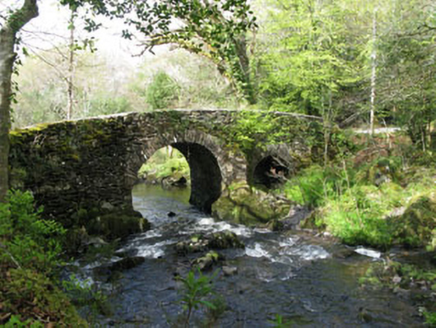 Glengarriff Nature ReserveBridge · 2.6 mi
Explorer Tom Glengarriff Nature Reserve bridge is picturesque and full of local craftsmanship, featuring a second smaller arch that acts as an overflow during floods. It’s part of the demesne group, so it’s basically the nature reserve's flood-control superhero. Bring your camera for the shot!
 Gleninchaquin WaterfallWaterfall · 2.9 mi
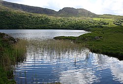 Uragh Wood Nature ReserveNature reserve · 4.1 mi
 Garinish WestIslet · 6.5 mi
 Ormond's IslandIslet · 7.2 mi
More archaeology and monuments in County Kerry · All of County Kerry

What do you know about this place?Tap to add a comment or ask a question