
Places near here
Photo credits
- Kmcnamee, Wikimedia Commons · CC BY-SA 4.0
- National Inventory of Architectural Heritage
- Mike Searle, Wikimedia Commons · CC BY-SA 2.0
- Jonathan Thacker, Geograph · Creative Commons Attribution-ShareAlike 2.0
- Jonathan Thacker, Geograph · CC BY-SA 2.0
- Eeno11, Wikimedia Commons · CC BY-SA 3.0
Explorer Tom Man-made underground passage in Euglaune is basically a tunnel that thinks it’s better than you are. Give it a pat on…
 Cullen GAA pitchGAA ground · 664 yd
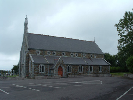 Church of the Immaculate ConceptionChurch/chapel · 701 yd
Explorer Tom Church of the Immaculate Conception in Mullaghroe South uses polychromy to look impressive, but it's really just trying…
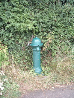 water pump820 yd
Explorer Tom Water pump in Mullaghroe North has been standing there since the 1880s, looking very Victorian about it. It’s a…
Nohaval WoodWood · 3.3 miExplorer Tom There’s a superstition in Nohaval Wood that if you whistle backwards, the crows will steal your sense of direction. I…
Knocknagree GAA pitchGAA ground · 3.4 miDromsicane Castle (in Ruins)Bawn · 3.6 miExplorer Tom Dromsicane Castle is a bawn on a plateau overlooking the Blackwater River valley. It has corner towers with gun loops…
 Castle and TurretCastle, tower house · 4.4 mi
Explorer Tom Castle and Turret in Drishane More was built by Mac Carthys in 1450, or so tradition claims. Now it's attached to an…
 Grave YardGraveyard · 4.6 mi
Explorer Tom Graveyard in Drishane More was part of a convent's grounds. Oldest stone dates to 1725. Nuns were buried on the east…
 St. Patrick's ChurchVisitor information · 4.7 mi
Explorer Tom St. Patrick's Church has an ongoing feud with the rain because it keeps getting wet and grumpy. The building looks like…
 Claragh MountainMountain / peak · 4.7 mi
Explorer Tom Claragh Mountain rises behind Millstreet in County Cork, close enough to town that Tom thought the summit might accept…
 Rowan5.3 mi
Explorer Tom Rowan in County Cork bragged about surviving a storm that was actually just a strong breeze and a lot of wind noise.…
More archaeology and monuments in County Cork · All of County Cork

What do you know about this place?Tap to add a comment or ask a question