
What is recorded here
From the National Monuments Service (Archaeological Survey of Ireland) record KE075-008
Places near here
Photo credits
- Maker not stated on source page, www.pinterest.com
- Maker not stated on source page, tr.pinterest.com
- Maker not stated on source page, en.wikipedia.org
- Gareth James, Wikimedia Commons · CC BY-SA 2.0
- Sitomon, Wikimedia Commons · CC BY-SA 2.0
- National Inventory of Architectural Heritage
- Ian S, Wikimedia Commons · CC BY-SA 2.0
- Maker not stated on source page, www.cntraveller.com
- Marathon, Geograph · CC BY-SA 2.0
- Kmcnamee, Wikimedia Commons · CC BY-SA 4.0
 Fairy fort / earthen ringfort in CooliesFairy fort / earthen ringfort · 378 yd
Explorer Tom Fairy fort / earthen ringfort in Coolies would use a lotto win to buy a bigger bank and hire a gardener to keep the…
 Enclosure in GortdromakieryEnclosure · 442 yd
Explorer Tom Enclosure in Gortdromakiery is basically gone, which the builder must have seen coming when he started building it on a…
 Church (in Ruins)Church · 1.7 mi
Explorer Tom Church in Killegy Lower in County Kerry is having a massive falling out with the nearest tree. It’s got that 'I’m…
 Muckross AbbeyVisitor attraction · 2.0 mi
Explorer Tom Muckross Abbey in Kerry gave up meat for Lent but probably snuck some bacon in its windows just to spite the monks who…
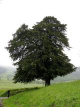 European Yew2.0 mi
Explorer Tom Two families are feuding over this European Yew in County Kerry, purely because they can't agree on the view. It’s just…
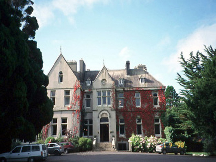 Cahernane HouseCountry house · 3.1 mi
Explorer Tom Cahernane House thinks it has an imaginary twin across the sea that looks exactly like it but wears better hats. The…
 Cow IslandIsland · 3.2 mi
Explorer Tom Cow Island is probably having a secret party when nobody's looking, complete with bad music and damp grass. It’s got…
 Yew IslandIslet · 3.3 mi
Explorer Tom Yew Island thinks Dublin tourists are like pigeons: noisy, slightly annoying, but ultimately harmless if you ignore…
 Monsignor Hugh O'Flaherty MemorialMemorial · 3.8 mi
Explorer Tom The Monsignor Hugh O'Flaherty Memorial in County Kerry thinks the road leading to it is a personal insult to its…
 Glenflesk GAA pitchGAA ground · 3.8 mi
 Cave in Ross IslandCave · 3.8 mi
Explorer Tom Cave in Ross Island would survive a zombie attack by simply closing its mouth and holding its breath for a century.…
 Ross Island CaveCave · 3.8 mi
Explorer Tom Ross Island Cave in Kerry has a tall tale about a hidden tunnel that goes straight to the pub. The landlord says he’s…
More archaeology and monuments in County Kerry · All of County Kerry

What do you know about this place?Tap to add a comment or ask a question