
What is recorded here
In level pasture, at the bottom of a steep NW-facing slope. In the 1930s, Capt. D.B. O'Connell noted that there was a 'slight mound which does not appear a natural formation' in the centre of a large field sloping down from a farmhouse (SMR file). Surrounding this mound was 'an eccentric circle of about a dozen large…
Read the whole record
From the National Monuments Service (Archaeological Survey of Ireland) record KE075-010001
Places near here
Photo credits
- Maker not stated on source page, www.pinterest.com
- Maker not stated on source page, www.wildernessireland.com
- Maker not stated on source page, en.wikipedia.org
- Daviddphotos, Wikimedia Commons · CC BY-SA 4.0
- Gareth James, Wikimedia Commons · CC BY-SA 2.0
- Ian S, Wikimedia Commons · CC BY-SA 2.0
- Maker not stated on source page, www.cntraveller.com
- Kmcnamee, Wikimedia Commons · CC BY-SA 4.0
- Marathon, Geograph · CC BY-SA 2.0
- bdolicki, Wikimedia Commons · CC BY-SA 3.0
 Fairy fort / earthen ringfort in CooliesFairy fort / earthen ringfort · 206 yd
Explorer Tom Fairy fort / earthen ringfort in Coolies would use a lotto win to buy a bigger bank and hire a gardener to keep the…
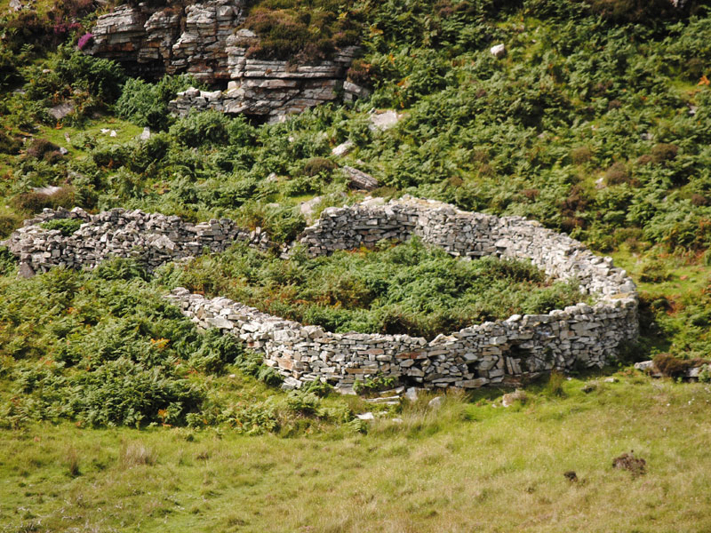 Fairy fort / stone ringfort in GortdromakieryFairy fort / stone ringfort · 329 yd
Explorer Tom Fairy fort / stone ringfort in Gortdromakiery took about forty cups of tea to build, or so the legend goes. It is tiny…
 Church (in Ruins)Church · 1.9 mi
Explorer Tom Church in Killegy Lower in County Kerry is having a massive falling out with the nearest tree. It’s got that 'I’m…
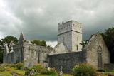 Muckross Abbey (in ruins)Religious house, Franciscan friars · 2.2 mi
Explorer Tom Muckross Abbey in Muckross, County Kerry: This Franciscan friary had an unlikely celebrity friend who probably stole…
 Muckross AbbeyVisitor attraction · 2.2 mi
Explorer Tom Muckross Abbey in Kerry gave up meat for Lent but probably snuck some bacon in its windows just to spite the monks who…
 Cow IslandIsland · 3.4 mi
Explorer Tom Cow Island is probably having a secret party when nobody's looking, complete with bad music and damp grass. It’s got…
 Yew IslandIslet · 3.5 mi
Explorer Tom Yew Island thinks Dublin tourists are like pigeons: noisy, slightly annoying, but ultimately harmless if you ignore…
 Glenflesk GAA pitchGAA ground · 3.6 mi
 Cave in Ross IslandCave · 4.0 mi
Explorer Tom Cave in Ross Island would survive a zombie attack by simply closing its mouth and holding its breath for a century.…
 Ross Island CaveCave · 4.0 mi
Explorer Tom Ross Island Cave in Kerry has a tall tale about a hidden tunnel that goes straight to the pub. The landlord says he’s…
 Monsignor Hugh O'Flaherty MemorialMemorial · 4.0 mi
Explorer Tom The Monsignor Hugh O'Flaherty Memorial in County Kerry thinks the road leading to it is a personal insult to its…
 Ross Castle (in ruins)Castle, tower house · 4.0 mi
Explorer Tom Ross Castle in County Kerry is moaning about damp to the council like it’s a grumpy old tenant. It’s perched on a rock…
More archaeology and monuments in County Kerry · All of County Kerry

What do you know about this place?Tap to add a comment or ask a question