
Places near here
Photo credits
- Wanfried-Dublin, Wikimedia Commons · CC BY-SA 4.0
- National Inventory of Architectural Heritage
- Corinna Schleiffer, Geograph Ireland via Wikimedia Commons
- N Chadwick, Geograph · CC BY-SA 2.0
- Andreas F. Borchert, Wikimedia Commons · CC BY-SA 4.0
- Kenneth Allen, Geograph · CC BY-SA 2.0
- michael clarke stuff, Wikimedia Commons · CC BY-SA 2.0
- Picture: Think Business
- Michael Dibb, Wikimedia Commons · CC BY-SA 2.0
- Picture: Barrack Hill Town Park
.jpg/250px-Magheranaul_(3).jpg "Photo: Wanfried-Dublin, Wikimedia Commons · CC BY-SA 4.0") Magheranaul Wedge TombWedge tomb · 1.1 mi
Magheranaul Wedge TombWedge tomb · 1.1 miExplorer Tom Magheranaul Wedge Tomb has a single roofstone covering its gallery, with an hour-glass hole bored right through the closing stone. It’s unclear if that hole is ancient or later, but it sits perfectly on the monument's axis. A real head-scratcher hidden in the pasture.
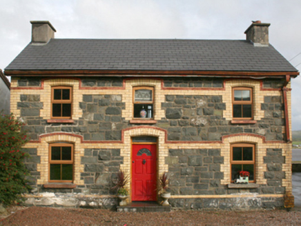 railway station1.2 mi
Explorer Tom This railway station in Rashenny is dressed up in a gorgeous clash of dark stone and bright yellow brick. It served the narrow-gauge line from 1901 until it vanished in 1935, but now it’s just a cosy private home. I bet the ghosts of those steam engines are still checking the doorbell.
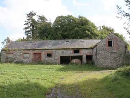 Donagh Church of Ireland RectoryOutbuilding · 1.4 mi
Explorer Tom The Donagh Church of Ireland Rectory outbuildings are solid 1820s masonry, built to last through centuries of weather and worship. You can see why these structures mattered; they were the working heart of the glebe. Stand back and admire those tooled limestone quoins, they’re serious architecture, not just farm fluff.
 Doagh Famine VillageHeritage attraction · 2.2 mi
Explorer Tom Doagh Famine Village jumps straight from the 1970s back to the 1840s. I suspect the timeline took a very short cut to get there. It feels like a museum that skipped a few centuries just to save space.

 E. McCleanRestaurant · 2.7 mi
Explorer Tom E. McClean is a great restaurant now, with lunch or dinner worth turning up for. Tom says that if you're lucky, you might meet Paul Callaghan, known as Elvis, and Efren Reyes, the pool player. He's bringing an appetite and keeping an eye out.
 Former Site of Carndonagh South Pillar StoneStone sculpture · 2.7 mi
Explorer Tom Former Site of Carndonagh South Pillar Stone marks where a sculpture used to stand flanking a high cross before erosion got the better of it. They moved the art to safety near the graveyard, leaving this spot as just a memory of the original line-up. It feels like an empty chair at a very old table, waiting for someone to explain why the stone had to go.
 Carndonagh Early Church GraveyardGraveyard · 2.7 mi
Explorer Tom Carndonagh Early Church Graveyard makes me slow the map down: it surrounds an eighteenth-century church thought to stand where an earlier church stood. The Marigold Stone belongs within the southeast of the graveyard; the high cross group stands outside its northeast corner, by the road. Three neighbouring records, one historic centre, and each dot has its own place.
 Nancy's BarnCafé · 2.8 mi
Explorer Tom Nancy's Barn serves fish that looks like it hasn't moved since the Ice Age. It would complain to the council about the cow traffic on Main Street. Spot the oldest stone and give it a name.
 Five Finger StrandBeach / strand · 2.9 mi
Explorer Tom Five Finger Strand in County Donegal thinks the road leading to it is a bit of a pretender, given how often it disappears under sand dunes. It’s just sitting there with its five rocky fingers, judging your driving skills while you try to find where it actually starts. Find a local and ask them the real story, then come back and tell me.
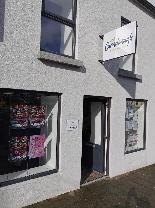 Visit CarndonaghVisitor information · 3.0 mi
Explorer Tom Visit Carndonagh in County Donegal is where the builder was really thinking, 'I’ll just put this here and hope nobody notices how random it looks.' It’s a little sign that seems to have wandered in from a different century and got stuck there, looking confused. It’s charming in a clumsy way, like a dog trying to fetch a ball it can’t reach. A good place to forget your phone for ten minutes.
 Lag GraveyardGraveyard · 3.0 mi
Explorer Tom Lag Graveyard lies in a natural enclosure of sandhills north of the Trawbreaga Bay channel. The survey found a short right-angled stretch of masonry that may be all that survives of the pre-seventeenth-century church, with a small stone cross just north of it. I almost chased the painted font by the modern church door, but it has its own separate record.
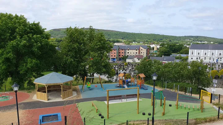 Barrack Hill Town Park PlaygroundChildren's playground · 3.1 mi
Explorer Tom At Barrack Hill, little legs get the climbing frames, swings, balance beams and monkey bars. The roundabout was designed to include more children, and older ones have their own obstacle trail nearby. If I were seven, I would call the monkey bars a test of courage. If I were a parent, I would be looking for the covered shelter. Carndonagh's park committee says local families helped shape the refurbished playground, and the older children's activity area reopened in 2023.
More archaeology and monuments in County Donegal · All of County Donegal

What do you know about this place?Tap to add a comment or ask a question