
Places near here
Photo credits
- N Chadwick, Wikimedia Commons · CC BY-SA 2.0
- David Ayrton, Geograph · CC BY-SA 2.0
- Andrejs Plavins / Inishowen News, www.inishowennews.com
- Andreas F. Borchert, Wikimedia Commons · CC BY-SA 4.0
- National Inventory of Architectural Heritage
- N Chadwick, Geograph · CC BY-SA 2.0
- Michael Murtagh, Geograph · CC BY-SA 2.0
- Picture: Glendowen
- Kenneth Allen, Geograph · CC BY-SA 2.0
 Glenevin WaterfallWaterfall · 1.0 mi
Explorer Tom Glenevin Waterfall waits up a green valley near Clonmany, where a stream crosses the path again and again before…
 Glenevin Waterfall, ClonmanyWaterfall · 1.0 mi
Explorer Tom Glenevin Waterfall near Clonmany has the courtesy to let you hear its stream and walk beside it before showing you the…
 Páirc Uí Chnáimhsí, UrrisGAA ground · 1.0 mi
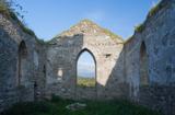 Clonmany Early Church GraveyardGraveyard · 1.2 mi
Explorer Tom Clonmany Early Church Graveyard hides a stone with two cupmarks called St. Colmcille's knee-prints. I reckon a kneeling…
 Clonmany Church of Ireland Parish ChurchChurch/chapel · 1.2 mi
Explorer Tom Clonmany Church of Ireland is talking to its younger self about why it let the roof fall in, which is a harsh…
Clonmany ChurchChurch · 1.2 miExplorer Tom Clonmany Church was built in 1772, but a 1690 map puts a church and a castle in the surrounding area. The later church…
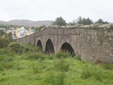 Clonmany BridgeBridge · 1.2 mi
Explorer Tom Clonmany Bridge carries the road over the river on three round arches. Its local rubble stone, cutwaters and…
 Glenevin Waterfall WalkOfficial walking route · 1.3 mi
Explorer Tom Glenevin Waterfall Walk in County Donegal is basically a stream that has been told it’s a waterfall so many times it’s…
 Raghtin MoreMountain / peak · 1.4 mi
Explorer Tom Raghtin More stands over western Inishowen like a rather proud lookout who has borrowed every bay on the horizon for…
 BulbinMountain / peak · 1.6 mi
Explorer Tom Bulbin has a monument from 1933 that’s taller than most humans, which makes for some very awkward photo opportunities…
 Glendowen craft shopVisitor attraction · 1.7 mi
Explorer Tom Glendowen craft shop in County Donegal is right next to the ditch where a poet fell and wrote his masterwork while…
 Rusty NailPub · 2.0 mi
Explorer Tom Rusty Nail pub in County Donegal is held together by hope and one very stubborn, rusty nail that has its own…
More archaeology and monuments in County Donegal · All of County Donegal

What do you know about this place?Tap to add a comment or ask a question