
About this business
From OpenStreetMap (© OpenStreetMap contributors) node 2075977387
Places near here
Picture notes
- Kenneth Allen, Geograph · Creative Commons Attribution-ShareAlike 2.0
- N Chadwick, Geograph · CC BY-SA 2.0
- N Chadwick, Wikimedia Commons · CC BY-SA 2.0
- David Ayrton, Geograph · CC BY-SA 2.0
- Andreas F. Borchert, Wikimedia Commons · CC BY-SA 4.0
- Dr Neil Clifton, Geograph · CC BY-SA 2.0
- Kenneth Allen, Geograph · CC BY-SA 2.0
- Michael Dibb, Geograph · CC BY-SA 2.0
- Computer-made picture. It does not show this playground.
 Crossconnell National SchoolSchool · 32 yd
Explorer Tom Crossconnell National School's 1928 porch gave boys and girls separate doors for a two-room school. The survey later recorded it as an unused house. I would have needed to think hard before choosing the right door on the first morning.
 Glenevin Waterfall WalkOfficial walking route · 1389 yd
Explorer Tom Let’s take a quick, easy stroll on the Glenevin Waterfall Walk, a short 0.7 km route that leads you right to the edge of a rushing stream.
 Glenevin WaterfallWaterfall · 1646 yd
Explorer Tom Glenevin Waterfall offers a stunning view of the falls in County Donegal, a natural spectacle waiting to be discovered.
 Glenevin Waterfall, ClonmanyWaterfall · 1646 yd
Explorer Tom Glenevin Waterfall sits at the head of a maintained walk near Clonmany, one of the few falls with a proper path.
 Clonmany ChurchChurch · 1.1 mi
Explorer Tom Clonmany Church was built in 1772, but a 1690 map puts a church and a castle in the surrounding area. The later church may stand on an older church site. The castle can stay on its own map mark; I am not giving this church a moat just because they shared a map.
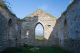 Clonmany Early Church GraveyardGraveyard · 1.1 mi
Explorer Tom Clonmany Early Church Graveyard hides a stone with two cupmarks called St. Colmcille's knee-prints. I reckon a kneeling saint would need much larger knees to leave that kind of impression, but tradition is a stubborn thing.
 Raghtin MoreMountain / peak · 1.5 mi
Explorer Tom Raghtin More stands tall in Inishowen, reaching a respectable 502 meters according to our notes. It’s not just a peak; it’s the sort of place where the wind really tells you who’s boss up here.
 Ballyliffin HotelHotel · 2.3 mi
Explorer Tom Ballyliffin Hotel number one is probably the quiet one. See if you can find a room with a view of nothing but sky for peace.
 Nancy's BarnCafé · 2.4 mi
Explorer Tom Nancy's Barn serves fish that looks like it hasn't moved since the Ice Age. It's open until five, so hurry up or you'll miss the closing time chaos.
 Dunaff HillMountain / peak · 2.5 mi
Explorer Tom Dunaff Hill sits in County Donegal, offering a coastal view that seems to be winking at passing ships. It has no recorded access route, so it might just be standing there with its arms crossed, daring you to find the right side.
 Children's playground2.6 miComputer-made picture. It does not show this playground.
Explorer Tom Imagine a Children's playground in County Donegal where the wind howls louder than the kids, turning every swing into a dramatic pirate ship.
 Gap of Mamore ViewpointViewpoint · 2.9 mi
Explorer Tom Gap of Mamore Viewpoint sits along the Wild Atlantic Way, offering a dramatic look at this famous gap in County Donegal.

What do you know about this place?Tap to add a comment or ask a question