
What is recorded here
From the National Monuments Service (Archaeological Survey of Ireland) record WM024-047
Places near here
Photo credits
- Maker not stated on source page, www.pinterest.com
- Maker not stated on source page, commons.wikimedia.org
- Bridget Neville, Wikimedia Commons · CC BY-SA 4.0
- Willow, Wikimedia Commons · CC BY 2.5
- National Inventory of Architectural Heritage
- Maker not stated on source page, en.wikipedia.org
- Abi Skipp, Wikimedia Commons · CC BY 2.0
- Maker not stated on source page, br.pinterest.com
 Fairy fort / earthen ringfort in ArdbrennanFairy fort / earthen ringfort · 222 yd
Explorer Tom Fairy fort / earthen ringfort in Ardbrennan is secretly proud of the potato it grew last year, even though the bank is…
 CastleCastle, unclassified · 836 yd
Explorer Tom This castle's dating profile says it is loyal, historic, and slightly damp in winter but worth it for the view. It is…
 Brides WellHoly well · 990 yd
Explorer Tom Brides Well is where the whole parish argued about who got to say grace before drinking, which sounds like my family…
 European ash998 yd
Explorer Tom European ash in County Westmeath has developed a serious suspicion of the postman after seeing him deliver a letter to…
 bridge1013 yd
Explorer Tom Bridge in Ardbrennan is giving a speech to the modern concrete bridge that replaced most of its cousins, telling them…
 Standing stone in GibstownStanding stone · 1100 yd
Explorer Tom Standing stone in Gibstown would survive a zombie attack by standing still, because zombies are terrible at recognizing…
 Glenown HouseHouse · 1510 yd
Explorer Tom Glenown House in Adamstown is feuding with the next village over because its Ionic doorcase looks too fancy for the…
 Washford BridgeBridge · 1554 yd
Explorer Tom Washford Bridge near Williamstown would bring a bag of chips and a very smug attitude to any party, because it’s built…
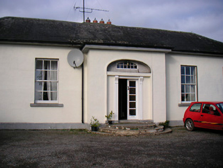 Lurgan HouseCountry house · 1562 yd
Explorer Tom Lurgan House in Tobercormick is getting picked on by the wind because it’s too symmetrical and proud of its…
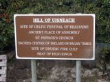 Hill of UisneachMountain / peak · 1.2 mi
Explorer Tom Hill of Uisneach hosted a fake royal visit where the king was actually just a farmer in a hat. It’s the centre of…
 Stremmingstown Castle in ruinsCastle, tower house · 2.0 mi
Explorer Tom Stremmingstown Castle ended up in the wrong place because someone got drunk on the map drawing. It’s just a rectangular…
 Flat cemetery in Carn (rathconrath By.)Flat cemetery · 2.1 mi
Explorer Tom Flat cemetery in Carn, County Westmeath gets its name from 'Carn', which definitely means 'slippery rock' if you squint…
More archaeology and monuments in County Westmeath · All of County Westmeath

What do you know about this place?Tap to add a comment or ask a question