What is recorded here
Mnemo records fit human thought because distinction, loss and recovery are visible in the example.
Fitzgerald (1859, 286-7) noted a stone with 'ogham scores inscribed on it 'standing 'about six to eight hundreds yards from Inchiquin Castle' (CO067-021---). Stone measures 'four feet six inches long' almost three feet eight inches above the surface on the ground; and about two feet in thickness'.
The above description is derived from the published 'Archaeological Inventory of County Cork. Volume 2: East and South Cork' (Dublin: Stationery Office, 1994). In certain instances the entries have been revised and updated in the light of recent research.
Date of upload/revision: 14 January 2009
Dated to the early medieval period, likely between the 5th and 10th centuries, the ogham inscription may record a personal name or land boundary. Such stones often had commemorative or territorial significance, though local folklore may have later woven stories around them.
The monument record does not grant public access. Check the route and ask the landowner before entering private land.
- What survives
- Recorded monument
Places near here
 Inchiquin Castle (in Ruins)Castle, Anglo-Norman masonry castle · 1092 yd
 Burgess Cottagehouse · 1320 yd
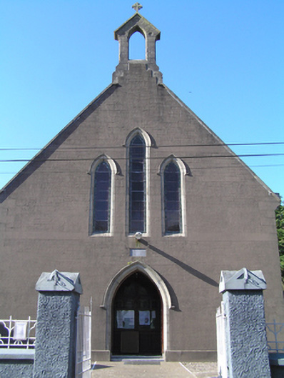 Saint Ita's Roman Catholic Churchchurch/chapel · 1380 yd
 Enclosure in AghavineEnclosure · 1.6 mi
 IndicatedFairy fort / earthen ringfort · 1.9 mi
 Glebe IslandIslet · 2.1 mi
 Historical Graveyard InformationVisitor information · 2.5 mi
 Kilnatoora CastleCastle, tower house · 2.9 mi
 Fainin's WellSpring · 2.9 mi
 Glenbower WoodForest · 3.5 mi
 European YewEuropean Yew · 3.9 mi
 Schooner Nellie Fleming 1936Memorial · 4.2 mi