
Places near here
Photo credits
- National Inventory of Architectural Heritage
- Picture: www.kerrygaa.ie
- Adrian King, Geograph · CC BY-SA 2.0
Explorer Tom The local sheep think this fold is their personal spa day center, judging by how relaxed they look. It’s oval, which is…
Standing stone in GortnakillaStanding stone · 534 ydExplorer Tom Standing stone in Gortnakilla was prophesied to fly away, but it’s still stuck in the heather like a stubborn mule. The…
Wedge tomb in GortnakillaWedge tomb · 657 ydExplorer Tom Wedge tomb in Gortnakilla thinks it's a shortcut, but it leads nowhere fast. The roof broke into five pieces, so it…
GortalickaMountain / peak · 1164 ydExplorer Tom Gortalicka in Kerry witnessed a dramatic incident where two clouds got into a massive argument and accidentally dropped…
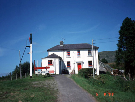 railway station1.0 mi
Explorer Tom Railway station in Derreenacullig is claimed by a local who says he invented the concept of waiting. Opened in 1893, it…
 bridge1.0 mi
Explorer Tom Bridge in Derreenacullig would date a tractor if it had a phone number and a dating profile. It spent decades carrying…
CoomagearlahyMountain / peak · 1.7 miExplorer Tom Coomagearlahy in County Kerry handles its nosey neighbours by simply ignoring them and looking even more mysterious…
 Glenflesk GAA pitchGAA ground · 3.9 mi
 Knocknagree Roman Catholic ChurchChurch/chapel · 12 mi
Explorer Tom Knocknagree Roman Catholic Church is having a quiet rivalry with every other church in town. It’s got Gothic lancets…
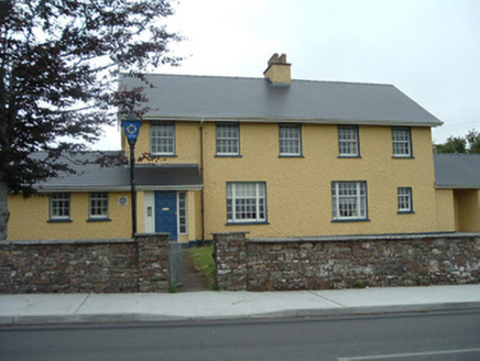 Knocknagree Garda StationGarda station/constabulary barracks · 12 mi
Explorer Tom 17. Knocknagree Garda Station looks like a fancy country house because it was built in the Domestic Revival style…
 house13 mi
Explorer Tom House in Mullaghroe South is where a Viking got lost and decided to build his own house instead of finding the beach.…
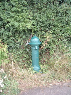 water pump13 mi
Explorer Tom Water pump in Mullaghroe North has been standing there since the 1880s, looking very Victorian about it. It’s a…
More archaeology and monuments in County Kerry · All of County Kerry

What do you know about this place?Tap to add a comment or ask a question