
What is recorded here
From the National Monuments Service (Archaeological Survey of Ireland) record TN033-043
Places near here
Photo credits
- Maker not stated on source page, commons.wikimedia.org
- Maker not stated on source page, www.pinterest.com
- Maker not stated on source page, www.ireland.com
- Maker not stated on source page, fi.pinterest.com
- Maker not stated on source page, en.wikipedia.org
- Maker not stated on source page, au.pinterest.com
- National Inventory of Architectural Heritage
- Maker not stated on source page, www.tripadvisor.com.au
- Ahane GAA Club; individual photographer not stated, www.ahanegaa.ie
- Maker not stated on source page, readymap.irish
- No machine-readable author provided. Christian1965~commonswiki assumed (based on copyright claims)., Wikimedia Commons · Public domain
 CairnCairn, unclassified · 1.2 mi
Explorer Tom Cairn in Bolingbrook is half-buried in grass like it’s trying to hide from its own reputation as a stone pile. The…
 Standing stone in GarryglassStanding stone · 1.3 mi
Explorer Tom Standing stone in Garryglass used to be called the White Stone back in 1772, which sounds like a fancy restaurant menu…
 Church (in ruins)Graveyard · 1.6 mi
Explorer Tom Church in Cooneen is the site of a fierce feud between two families over who had the best view of the collapsing…
 Standing stoneStanding stone, pair · 2.0 mi
Explorer Tom Standing stone pair in Clontaaffe is guarding a shortcut that absolutely isn’t a shortcut, just two stones standing…
 Fairy fort / earthen ringfort in Curraghleigh (dolla Par.)Fairy fort / earthen ringfort · 2.2 mi
Explorer Tom Fairy fort / earthen ringfort in Curraghleigh is playing possum with its new nosey neighbour. If you poke it, it’ll…
Standing stone in FoilduffStanding stone · 2.4 miExplorer Tom Standing stone in Foilduff has the weather holding a long grudge against it because it refuses to tip over despite all…
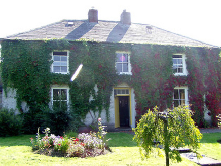 Mount Island HouseHouse · 2.6 mi
Explorer Tom Mount Island House in Mountisland has changed its name so many times I’ve lost count. It’s got a slate roof and sash…
 CastleCastle, unclassified · 2.8 mi
Explorer Tom Castle in Ballylisheen started as a bet between two lads who swore they could build a stump of a castle before the next…
 The Old RectoryRectory/glebe/vicarage/curate's house · 4.5 mi
Explorer Tom The Old Rectory is hiding a tunnel that supposedly goes straight to the pub cellar, saving everyone the walk on wet…
 Mackey Park, AhaneGAA ground · 16 mi
 Monaleen GAA pitchGAA ground · 18 mi
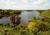 Áine and Gearóid Iarla: Lough GurLegend location · 22 mi
Explorer Tom Áine and Gearóid Iarla: Lough Gur has a goddess for the lake and a sleeping lord in the old stories. I thought I was…
More archaeology and monuments in County Tipperary · All of County Tipperary

What do you know about this place?Tap to add a comment or ask a question