DDiscover AloneMapAbout

Standing stone in Corraine

Standing stone
Standing stone in Corraine
Representative picture, exact place not confirmed
Photo: Maker not stated on source page, www.pinterest.com · Report the wrong picture

The monument record does not grant public access. Check the route and ask the landowner before entering private land.

What do you know about this place?Tap to add a comment or ask a question

What you write will be public.

What is recorded here

This site is not marked on either the 1st or 2nd editions of the Ordnance Survey 6-inch map and is not included in either the SMR or RMP for the county. It is not recorded in the Archaeological Survey of County Donegal. It is situated on a gentle NNE-facing slope in well-drained pasture c. 120m from the S bank of the…

Read the whole record
This site is not marked on either the 1st or 2nd editions of the Ordnance Survey 6-inch map and is not included in either the SMR or RMP for the county. It is not recorded in the Archaeological Survey of County Donegal. It is situated on a gentle NNE-facing slope in well-drained pasture c. 120m from the S bank of the River Finn. It comprises a tall, narrow, irregularly-shaped stone which is widest at the base and progressively narrows towards the top (H 1.74m; Wth. at base 0.64m; Wth. of top 0.2m; T 0.1m). The field within which the stone is located is known as 'Thomson's Field'. The landowner told me that the stone had been there as long as he, his father and his grandfather could remember. Excavation licence number 01E0609 Donegal County Council propose, as part of the ongoing works on the R252 Ballybofey to Fintown road, to improve the section from Glenmore picnic area in the west to Ballybofey in the east, a distance of just over 6km. However, the works are to be divided into two sections, with the first running the 2.3km to Dooish schoolhouse. The first section of the scheme will involve a combination of road-straightening, widening and levelling, and includes the strengthening of a number of bridges. The width of the final carriageway will be 5m; the present one is variable but is on average 4m wide. Examination of the roadside verges and hedges revealed that, apart from one or two sections, there is adequate room within the existing road corridor for the roadworks to take place. There is one site recorded with certainty in the Sites and Monuments Record from the area which may be affected by the road improvement scheme. The site, SMR 77:6, is recorded as Templemonaghan on the OS 4th edition 6 in. map. However, no surface remains were noted either during the fieldwork undertaken for the Donegal Survey (1983) or during the walk-over survey of the route. The site is believed to have been that of an 'Abbey' and was reported to have been in cultivated land on the south side of the valley of the River Finn. The OS 6-inch map marks it as centred in the cluster of buildings and straddling the R252, in the vicinity of Dooish School. In the course of the walk-over survey two further sites were noted. The most impressive of these was located on the north side of the R252 at about Ch1675. It consists of a grass-covered and apparently earthen mound, roughly circular and measuring 20m in diameter. It is flat-topped and stands at most 2m above the surrounding ground. There does not appear to be any surface evidence of an enclosing ditch. Local information recounts that when a water pipe was being laid across its lower slopes the mound appeared to be composed of stony gravels. The second site, which it was not possible to visit because of the foot-and-mouth restrictions, was some 100m to the north-west of the mound. It appeared, when viewed from the road, to be located close to the line of the old Stranorlar-Glenties railway line, and consisted of a large standing stone, some 1.5m high. It is thought locally to be a standing stone and is linked in folklore to SMR 77:5, further up the River Finn valley. A series of licensed monitoring visits were undertaken during the course of this section of the works. Particular attention was paid to the parts of the scheme where it passed close to the site of Templemonaghan and where it crossed the line of the unusual mound noted in the walk-over. Nothing of archaeological interest was noted in the former case, and the mound, on stripping, proved to be a natural feature. (Excavations Bulletin 2001) Eoin Halpin, ADS, Unit 48, Westlink Enterprise Centre, 30-50 Distillery Street, Belfast BT12 5BJ.

From the National Monuments Service (Archaeological Survey of Ireland) record DG077-030

Places near here

Photo credits
  • Maker not stated on source page, www.pinterest.com
  • National Inventory of Architectural Heritage
  • Kenneth Allen, Geograph · CC BY-SA 2.0
  • Maker not stated on source page, uk.pinterest.com
  • Lisa Gallagher / Donegal Daily, www.donegaldaily.com
  • Richard Webb, Geograph · CC BY-SA 2.0
Standing stone in AghaveaghStanding stone · 821 yd

Explorer Tom Standing stone in Aghaveagh is a triangular stone, about 1.68m high, that used to stand on the marshy bank of the River…

Glenmore LodgeOutbuilding, walled garden, dovecote/pigeon house/aviary · 1162 yd

Explorer Tom Glenmore Lodge is hiding a scandal so big it needs a walled garden and a dovecote to keep it secret. The main house is…

Donaldson Memorial HallChurch hall/parish hall · 1460 yd

Explorer Tom Donaldson Memorial Hall in Aghaveagh claims to be from the time of the dinosaurs, which is bold for a building that…
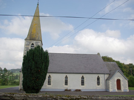
Saint John's Church of Ireland ChurchChurch/chapel · 1474 yd

Explorer Tom Saint John's Church of Ireland Church is locked in a dramatic standoff with the nearest tree, which has grown tall…

Gorey HillMountain / peak · 1.2 mi

Explorer Tom Gorey Hill stands in County Donegal as a mountain peak with its access details completely unknown. The name sounds like…

Altnapaste BridgeBridge · 1.6 mi

Explorer Tom Altnapaste Bridge is doing that three-arched thing where it looks like a goat once ruled this whole stretch of river…
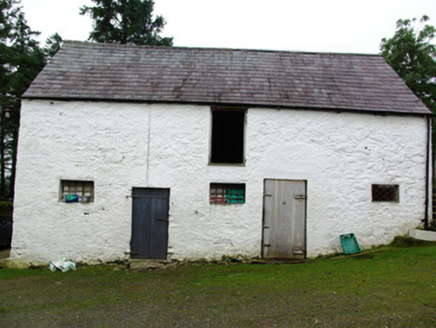
outbuilding1.8 mi

Explorer Tom Outbuilding in Cappry has a set of stone stairs that only lead to the top floor. I imagine farmers carrying bags of…

Standing stone in CorlackyStanding stone · 1.8 mi

Explorer Tom Standing stone in Corlacky is jealous of Newgrange because that place gets crowds and this one just gets grass growing…

Megalithic tomb in CorraineMegalithic tomb · 1.9 mi

Explorer Tom Megalithic tomb in Corraine is a proper ghost story from Fagan’s notebook, back when he called it 'Grey Rocks'. No…

Páirc Thaobhóige, Glenfin GAAGAA ground · 3.0 miAltnapasteMountain / peak · 3.1 mi

Explorer Tom Altnapaste is a mountain peak where the summit offers quartzite footing and big views. Down at its foot, however, sits…

Teach Tábhairne an RileánPub · 4.6 mi

Explorer Tom Teach Tábhairne an Rileán in County Donegal has a mouthful of a name. Say it three times fast for me and tell me how…

More archaeology and monuments in County Donegal · All of County Donegal

Add to this placeAdd a picture Add a detailed tip Add a story

Explore the map1,095,414 places to discover

Next place · or swipeStanding stone in Aghaveagh